File:Tokyo-to géolocalisation.svg

Size of this PNG preview of this SVG file: 800 × 488 pixels. Other resolutions: 320 × 195 pixels | 640 × 390 pixels | 1,024 × 625 pixels | 1,280 × 781 pixels | 2,560 × 1,561 pixels | 1,720 × 1,049 pixels.
Original file (SVG file, nominally 1,720 × 1,049 pixels, file size: 1.89 MB)
Captions
Captions
Add a one-line explanation of what this file represents
Summary edit
| Camera location | | View this and other nearby images on: OpenStreetMap |
|---|
| Description |
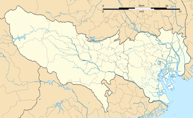
Français : Carte vierge de la préfecture métropolitaine de Tokyo (東京都, Tōkyō-to), au Japon, destinée à la géolocalisation.
Deutsch: Karte der Präfektur Tokio.
English: Blank map of the prefecture of en:Tokyo, for geolocalisation purpose.
Español: Mapa de la prefectura de Tokio.
Italiano: Mappa della metropoli di it:Tokyo.
日本語: 東京都の地図.
한국어: 도쿄도의 지도.
Português: Carta de la Metrópole de Tóquio.
|
||
| Date | (UTC) | ||
| Source |
Création personnelle ;
|
||
| Author | © Bourrichon (talk) - fr:Bourrichon | ||
| Permission (Reusing this file) |
|
||
| Other versions | File:Tokyo-to géolocalisation relief.svg |

|
This SVG file contains embedded text that can be translated into your language, using any capable SVG editor, text editor or the SVG Translate tool. For more information see: About translating SVG files. |
This W3C-unspecified vector image was created with Inkscape .
Licensing edit
I, the copyright holder of this work, hereby publish it under the following license:
This file is licensed under the Creative Commons Attribution-Share Alike 2.0 France license.
Attribution: Bourrichon (atelier graphique)
- You are free:
- to share – to copy, distribute and transmit the work
- to remix – to adapt the work
- Under the following conditions:
- attribution – You must give appropriate credit, provide a link to the license, and indicate if changes were made. You may do so in any reasonable manner, but not in any way that suggests the licensor endorses you or your use.
- share alike – If you remix, transform, or build upon the material, you must distribute your contributions under the same or compatible license as the original.

File history
Click on a date/time to view the file as it appeared at that time.
| Date/Time | Thumbnail | Dimensions | User | Comment | |
|---|---|---|---|---|---|
| current | 19:29, 2 July 2013 | | 1,720 × 1,049 (1.89 MB) | Bourrichon (talk | contribs) | +quelques rivières |
| 18:43, 2 July 2013 |  | 1,720 × 1,049 (1.06 MB) | Bourrichon (talk | contribs) | == {{int:filedesc}} == {{Location|35|70|00|N|139|00|00|E|scale:10000}} {{Information |Description= {{fr|Carte vierge de la préfecture métropolitaine de Tokyo (東京都, ''Tōkyō-to''), au Japon, destinée ... |
You cannot overwrite this file.
File usage on Commons
The following 12 pages use this file:
- User:SpinnerLaserzthe2nd/Flags/Flags of Japan/Japan/Tokyo
- File:Tokyo Wikivoyage locator maps - Bunkyo.png
- File:Tokyo Wikivoyage locator maps - Chiyoda.png
- File:Tokyo Wikivoyage locator maps - Chuo.png
- File:Tokyo Wikivoyage locator maps - Koto.png
- File:Tokyo Wikivoyage locator maps - Minato.png
- File:Tokyo Wikivoyage locator maps - Shibuya.png
- File:Tokyo Wikivoyage locator maps - Shinagawa.png
- File:Tokyo Wikivoyage locator maps - Shinjuku.png
- File:Tokyo Wikivoyage locator maps - Sumida.png
- File:Tokyo Wikivoyage locator maps - Taito.png
- File:Tokyo Wikivoyage locator maps - Toshima.png
File usage on other wikis
The following other wikis use this file:
- Usage on ar.wikipedia.org
- Usage on az.wikipedia.org
- Usage on ceb.wikipedia.org
- Usage on de.wikipedia.org
- Usage on en.wikipedia.org
- Shibuya
- Harajuku
- Ōta, Tokyo
- Tokyo Station
- Ōsaki Station
- Shinagawa Station
- Tamachi Station (Tokyo)
- Hamamatsuchō Station
- Harajuku Station
- Shinjuku Station
- Yūrakuchō Station
- Gotanda Station
- Meguro Station
- Ebisu Station (Tokyo)
- Ueno Station
- Ikebukuro Station
- Shibuya Station
- Shimbashi Station
- Yoyogi Station
- Keiō-hachiōji Station
- Okachimachi Station
- Akihabara Station
- Kanda Station (Tokyo)
- Yokota Air Base
- Nakano Station (Tokyo)
- Ochanomizu Station
- Iidabashi Station
- Tokyo Metropolitan University
- Chōfu Airport
- Takadanobaba Station
- Kyōbashi Station (Tokyo)
- Kabukichō
- Sengaku-ji
- Mejiro Station
- Nishi-Nippori Station
- Nippori Station
- Shin-Ōkubo Station
- Ōtsuka Station
- Sugamo Station
- Komagome Station
- Tachikawa Station
- Futako-tamagawa Station
- Shimo-kitazawa Station
- Hachiōji Station
View more global usage of this file.