File:Tomas nov 2 2010 1445Z.jpg

Size of this preview: 800 × 450 pixels. Other resolutions: 320 × 180 pixels | 640 × 360 pixels | 1,024 × 576 pixels | 1,280 × 720 pixels | 1,920 × 1,080 pixels.
Original file (1,920 × 1,080 pixels, file size: 2.06 MB, MIME type: image/jpeg)
Captions
Captions
Add a one-line explanation of what this file represents
Summary
edit
| Description |
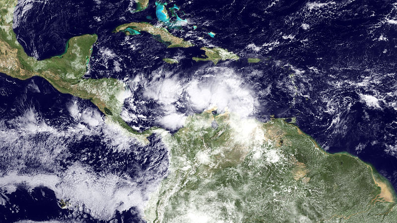
English: Imagery captured from GOES-East on November 2, at 1445Z, shows Tomas south of Port Au Prince, Haiti, moving west near 10 MPH, with winds near 50 MPH. The National Hurricane Center reports that strengthening is forecast during the next 48 hours and Tomas could regain hurricane strength by Wednesday. |
| Date | |
| Source | http://www.nnvl.noaa.gov/MediaDetail.php?MediaID=571&MediaTypeID=1 |
| Author | NOAA |
Licensing
edit
This image is in the public domain because it contains materials that originally came from the U.S. National Oceanic and Atmospheric Administration, taken or made as part of an employee's official duties.
|
File history
Click on a date/time to view the file as it appeared at that time.
| Date/Time | Thumbnail | Dimensions | User | Comment | |
|---|---|---|---|---|---|
| current | 22:28, 2 November 2010 | | 1,920 × 1,080 (2.06 MB) | Supportstorm (talk | contribs) | {{Information |Description={{en|1=Imagery captured from GOES-East on November 2, at 1445Z, shows Tomas south of Port Au Prince, Haiti, moving west near 10 MPH, with winds near 50 MPH. The National Hurricane Center reports that strengthening is forecast du |
You cannot overwrite this file.
File usage on Commons
There are no pages that use this file.