File:Tooti Rüüss bei Fischbach.jpg

Size of this preview: 800 × 575 pixels. Other resolutions: 320 × 230 pixels | 640 × 460 pixels | 1,024 × 736 pixels | 1,280 × 920 pixels | 2,560 × 1,841 pixels | 3,544 × 2,548 pixels.
Original file (3,544 × 2,548 pixels, file size: 2.91 MB, MIME type: image/jpeg)
Captions
Captions
Add a one-line explanation of what this file represents
Summary
edit
| Description |
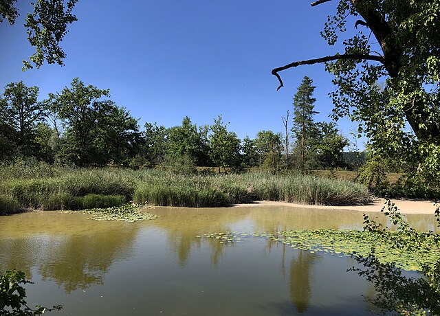
Deutsch: Naturschutzgebiet Tooti Rüüss, Fischbach-Göslikon, Kanton Aargau |
||
| Date | |||
| Source | Own work | ||
| Author | Arkelin | ||
| Importance |
|
| Camera location | | View this and other nearby images on: OpenStreetMap |
|---|
Licensing
edit
I, the copyright holder of this work, hereby publish it under the following license:
This file is licensed under the Creative Commons Attribution-Share Alike 4.0 International license.
- You are free:
- to share – to copy, distribute and transmit the work
- to remix – to adapt the work
- Under the following conditions:
- attribution – You must give appropriate credit, provide a link to the license, and indicate if changes were made. You may do so in any reasonable manner, but not in any way that suggests the licensor endorses you or your use.
- share alike – If you remix, transform, or build upon the material, you must distribute your contributions under the same or compatible license as the original.
File history
Click on a date/time to view the file as it appeared at that time.
| Date/Time | Thumbnail | Dimensions | User | Comment | |
|---|---|---|---|---|---|
| current | 10:35, 11 February 2023 | | 3,544 × 2,548 (2.91 MB) | Arkelin (talk | contribs) | Uploaded own work with UploadWizard |
You cannot overwrite this file.
File usage on Commons
The following page uses this file:
File usage on other wikis
The following other wikis use this file:
- Usage on de.wikipedia.org
- Wikipedia:WikiProjekt Schweiz/Kulturgüterschutzinventar/AG/Bezirk Baden
- Wikipedia:WikiProjekt Schweiz/Kulturgüterschutzinventar/AG/Bezirk Bremgarten
- Wikipedia:WikiProjekt Schweiz/Kulturgüterschutzinventar/AG/Bezirk Laufenburg
- Amphibienlaichgebiete von nationaler Bedeutung im Kanton Aargau
- Wikipedia:WikiProjekt Schweiz/Kulturgüterschutzinventar/AG/Bezirk Aarau
- Bundesinventar der Auengebiete von nationaler Bedeutung
- Auengebiete von nationaler Bedeutung im Kanton Aargau
- Usage on www.wikidata.org