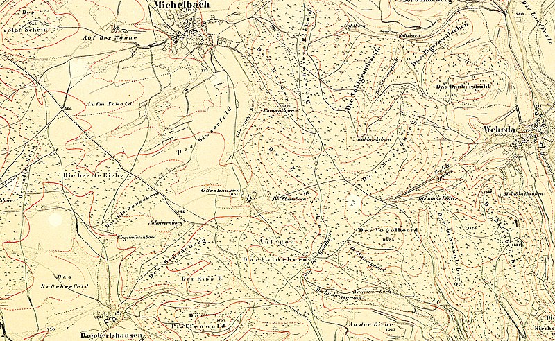
File:Topografische Karte Görzhausen 1857.JPG

Original file (2,577 × 1,586 pixels, file size: 3.04 MB, MIME type: image/jpeg)
Captions
Captions
Summary edit
| Title |
Topografische Karte von Görzhausen |
|||||||||
| DescriptionTopografische Karte Görzhausen 1857.JPG |
Deutsch: Topografische Karte des Kurfürstentums Hessen. |
|||||||||
| Date | ||||||||||
| Source |
|
|||||||||
| Creator |
Landesgeschichtliches Informationssystem Hessen (Lagis): Historische Kartenwerke |
|||||||||
| Permission (Reusing this file) |
|
|||||||||
| Geotemporal data | ||||||||||
| Date depicted | ||||||||||
| Map location |
Deutsch: Hessen |
|||||||||
| Map type | topographic map | |||||||||
| Scale | 1:25,000 | |||||||||
| Heading |
|
|||||||||
| Bounding box |
|
|||||||||
| Georeferencing | View the georeferenced map in the Wikimaps Warper | |||||||||
| Bibliographic data | ||||||||||
| Language | German | |||||||||
Licensing edit
| Public domainPublic domainfalsefalse |
|
This work is in the public domain in its country of origin and other countries and areas where the copyright term is the author's life plus 100 years or fewer. This work is in the public domain in the United States because it was published (or registered with the U.S. Copyright Office) before January 1, 1929. | |
| This file has been identified as being free of known restrictions under copyright law, including all related and neighboring rights. | |
https://creativecommons.org/publicdomain/mark/1.0/PDMCreative Commons Public Domain Mark 1.0falsefalse
File history
Click on a date/time to view the file as it appeared at that time.
| Date/Time | Thumbnail | Dimensions | User | Comment | |
|---|---|---|---|---|---|
| current | 09:36, 10 April 2021 |  | 2,577 × 1,586 (3.04 MB) | HeinrichStuerzl (talk | contribs) | larger map |
| 12:48, 3 April 2021 |  | 921 × 981 (796 KB) | HeinrichStuerzl (talk | contribs) | larger map | |
| 12:05, 11 September 2016 |  | 704 × 583 (260 KB) | HeinrichStuerzl (talk | contribs) | =={{int:filedesc}}== {{Information |description={{de|1=Topografische Karte von Görzhausen bei Marburg (1:25000).}} |date=1857 |source={{Extracted from|Kurfürstentum Hessen Blatt 60 Marburg.jpg}} |author=Landesgeschichtliches Informationssystem Hessen... |
You cannot overwrite this file.
File usage on Commons
The following 6 pages use this file:
File usage on other wikis
The following other wikis use this file:
- Usage on de.wikipedia.org
Metadata
This file contains additional information such as Exif metadata which may have been added by the digital camera, scanner, or software program used to create or digitize it. If the file has been modified from its original state, some details such as the timestamp may not fully reflect those of the original file. The timestamp is only as accurate as the clock in the camera, and it may be completely wrong.
| Width | 6,141 px |
|---|---|
| Height | 6,377 px |
| Bits per component |
|
| Compression scheme | Uncompressed |
| Pixel composition | RGB |
| Orientation | Normal |
| Number of components | 3 |
| Horizontal resolution | 300 dpi |
| Vertical resolution | 300 dpi |
| Data arrangement | chunky format |
| Software used | Adobe Photoshop CS6 (Windows) |
| File change date and time | 11:26, 10 April 2021 |
| Exif version | 2.21 |
| Color space | Uncalibrated |
| Date and time of digitizing | 19:57, 18 July 2013 |
| Date metadata was last modified | 13:26, 10 April 2021 |
| Unique ID of original document | xmp.did:CBA9ECBC7C2AE3119B51F99E01D0F664 |
