File:Topografische Karte Lahntal 1857.jpg

Original file (5,600 × 5,419 pixels, file size: 15.14 MB, MIME type: image/jpeg)
Captions
Captions
Summary edit
| Title |
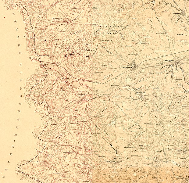
Topografische Karte vom Gebiet der heutigen Gemeinde Lahntal mit Brungershausen, Kernbach, Caldern, Sterzhausen bis Goßfelden sowie Warzenbach und Niederwetter im Norden und Michelbach und Elnhausen im Süden |
|||||
| DescriptionTopografische Karte Lahntal 1857.jpg |
Deutsch: Topografische Karte des Kurfürstentums Hessen. |
|||||
| Date | ||||||
| Source |
This file was derived from: |
|||||
| Creator |
Landesgeschichtliches Informationssystem Hessen (Lagis): Historische Kartenwerke |
|||||
| Permission (Reusing this file) |
|
|||||
| Geotemporal data | ||||||
| Date depicted | ||||||
| Map location |
Deutsch: Hessen |
|||||
| Map type | topographic map | |||||
| Scale | 1:25,000 | |||||
| Heading |
|
|||||
| Georeferencing | Georeference the map in Wikimaps Warper If inappropriate please set warp_status = skip to hide. | |||||
| Bibliographic data | ||||||
| Language | German | |||||
Licensing edit
| Public domainPublic domainfalsefalse |
|
This work is in the public domain in its country of origin and other countries and areas where the copyright term is the author's life plus 100 years or fewer. This work is in the public domain in the United States because it was published (or registered with the U.S. Copyright Office) before January 1, 1929. | |
| This file has been identified as being free of known restrictions under copyright law, including all related and neighboring rights. | |
https://creativecommons.org/publicdomain/mark/1.0/PDMCreative Commons Public Domain Mark 1.0falsefalse
File history
Click on a date/time to view the file as it appeared at that time.
| Date/Time | Thumbnail | Dimensions | User | Comment | |
|---|---|---|---|---|---|
| current | 11:22, 17 May 2022 |  | 5,600 × 5,419 (15.14 MB) | HeinrichStuerzl (talk | contribs) | {{Map |title =Topografische Karte vom Gebiet der heutigen Gemeinde Lahntal mit Brungershausen, Kernbach, Caldern, Sterzhausen bis Goßfelden sowie Warzenbach und Niederwetter im Norden und Michelbach und Elnhausen im Süden |description ={{de|1=Topografische Karte des Kurfürstentums Hessen.}} |legend = |author =Landesgeschichtliches Informationssystem Hessen (Lagis): Historische Kartenwerke |date... |
You cannot overwrite this file.
File usage on Commons
The following 4 pages use this file:
Metadata
This file contains additional information such as Exif metadata which may have been added by the digital camera, scanner, or software program used to create or digitize it. If the file has been modified from its original state, some details such as the timestamp may not fully reflect those of the original file. The timestamp is only as accurate as the clock in the camera, and it may be completely wrong.
| Orientation | Normal |
|---|---|
| Horizontal resolution | 72 dpi |
| Vertical resolution | 72 dpi |
| Software used | Adobe Photoshop CS6 (Windows) |
| File change date and time | 13:05, 17 May 2022 |
| Color space | sRGB |
| Date and time of digitizing | 14:48, 17 May 2022 |
| Date metadata was last modified | 15:05, 17 May 2022 |
| Unique ID of original document | xmp.did:48D7BF44C9D5EC11913A950BE7DD3D5C |

