File:Topographia Franconiæ - ZEILLER, Martin, 1648.jpg
Size of this preview: 774 × 600 pixels. Other resolutions: 310 × 240 pixels | 619 × 480 pixels | 991 × 768 pixels | 1,280 × 992 pixels | 2,560 × 1,984 pixels | 3,584 × 2,778 pixels.
Original file (3,584 × 2,778 pixels, file size: 2.2 MB, MIME type: image/jpeg)
Captions
Captions
Add a one-line explanation of what this file represents
Summary
edit
| Description |
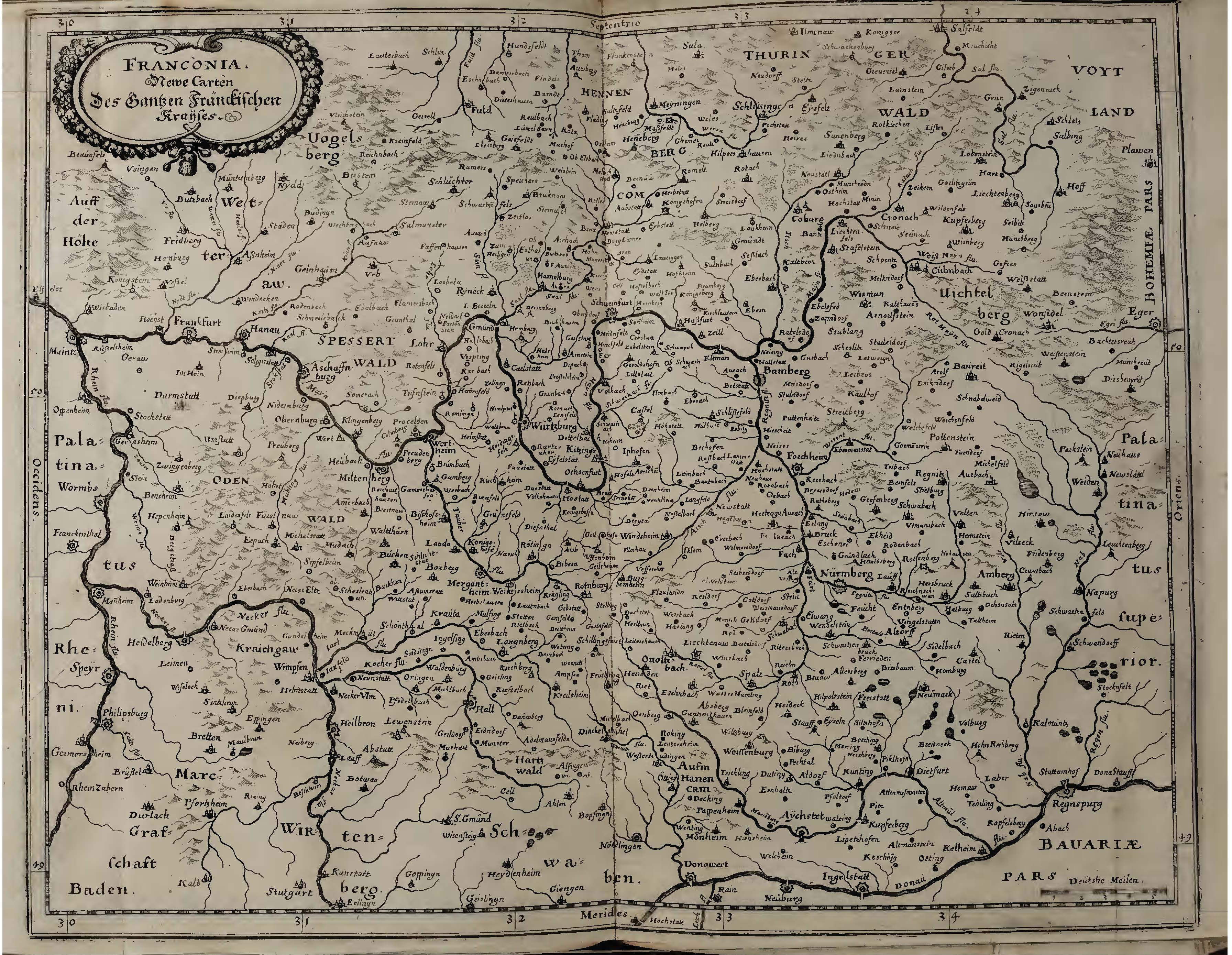
Čeština: Mapa Franconie z Topographia Franconiæ od Martina Zeillera podle původní rytiny od Matthaeus Meriana, rok 1648
English: Map of Franconia from Topographia Franconia by Martin Zeiller according to the original engraving by Matthaeus Merian, year 1648 |
| Date | |
| Source | Topographia Franconiæ, Zeiller, Martin, 1648 |
| Author | Zeiller, Martin |
https://archive.org/details/topographiafranc00zeil/page/n13/mode/2up
Licensing
edit
This file is licensed under the Creative Commons Attribution-Share Alike 4.0 International license.
- You are free:
- to share – to copy, distribute and transmit the work
- to remix – to adapt the work
- Under the following conditions:
- attribution – You must give appropriate credit, provide a link to the license, and indicate if changes were made. You may do so in any reasonable manner, but not in any way that suggests the licensor endorses you or your use.
- share alike – If you remix, transform, or build upon the material, you must distribute your contributions under the same or compatible license as the original.
File history
Click on a date/time to view the file as it appeared at that time.
| Date/Time | Thumbnail | Dimensions | User | Comment | |
|---|---|---|---|---|---|
| current | 10:57, 13 April 2020 | | 3,584 × 2,778 (2.2 MB) | Evzen M (talk | contribs) | Uploaded a work by Zeiller, Martin from Topographia Franconiæ, Zeiller, Martin, 1648 with UploadWizard |
You cannot overwrite this file.
File usage on Commons
There are no pages that use this file.
File usage on other wikis
The following other wikis use this file:
- Usage on cs.wikipedia.org