File:Topographic atlas of the City and County of Denver, Colorado - DPLA - 3f68bd3f513e9d7dfddd8cefbdbf55c0 (page 60).jpg

Size of this preview: 713 × 600 pixels. Other resolutions: 285 × 240 pixels | 571 × 480 pixels | 913 × 768 pixels | 1,218 × 1,024 pixels | 2,436 × 2,048 pixels | 7,801 × 6,560 pixels.
Original file (7,801 × 6,560 pixels, file size: 3.7 MB, MIME type: image/jpeg)
Captions
Captions
Add a one-line explanation of what this file represents
Summary
editThis file was uploaded by the Digital Public Library of America, and the following item metadata was created by the contributing institution's staff.
Note: this data is being maintained by an automated bot, synced with the source data.
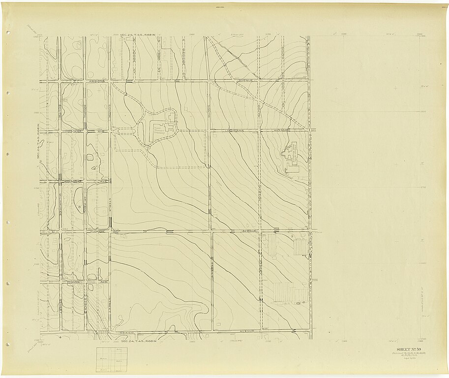
| Description | Shows streets, buildings, with public buildings identified, parks, bodies of water, range and township., Scale [1:2,400]. 1 inch = 200 feet ; Lambert proj | ||||||||||||||||||||
| Title | Topographic atlas of the City and County of Denver, Colorado, U.S.G.S. Denver survey topographic sheets; W.P.A. project no. 674 | ||||||||||||||||||||
| Institution |
|
||||||||||||||||||||
| Subject | |||||||||||||||||||||
| Source |
Plains to Peaks Collective |
||||||||||||||||||||
| Author |
Geological Survey (U.S.) |
||||||||||||||||||||
| Permission (Reusing this file) |
Copyright determination made by Denver Public Library (Q69470198) using RightsStatements.org
|
||||||||||||||||||||
| Partnership |
|
||||||||||||||||||||


.jpg&action=edit§ion=1)
File history
Click on a date/time to view the file as it appeared at that time.
| Date/Time | Thumbnail | Dimensions | User | Comment | |
|---|---|---|---|---|---|
| current | 13:20, 18 December 2020 | | 7,801 × 6,560 (3.7 MB) | DPLA bot (talk | contribs) | Uploading DPLA ID 3f68bd3f513e9d7dfddd8cefbdbf55c0 |
You cannot overwrite this file.
File usage on Commons
There are no pages that use this file.
.jpg&oldid=803240096)