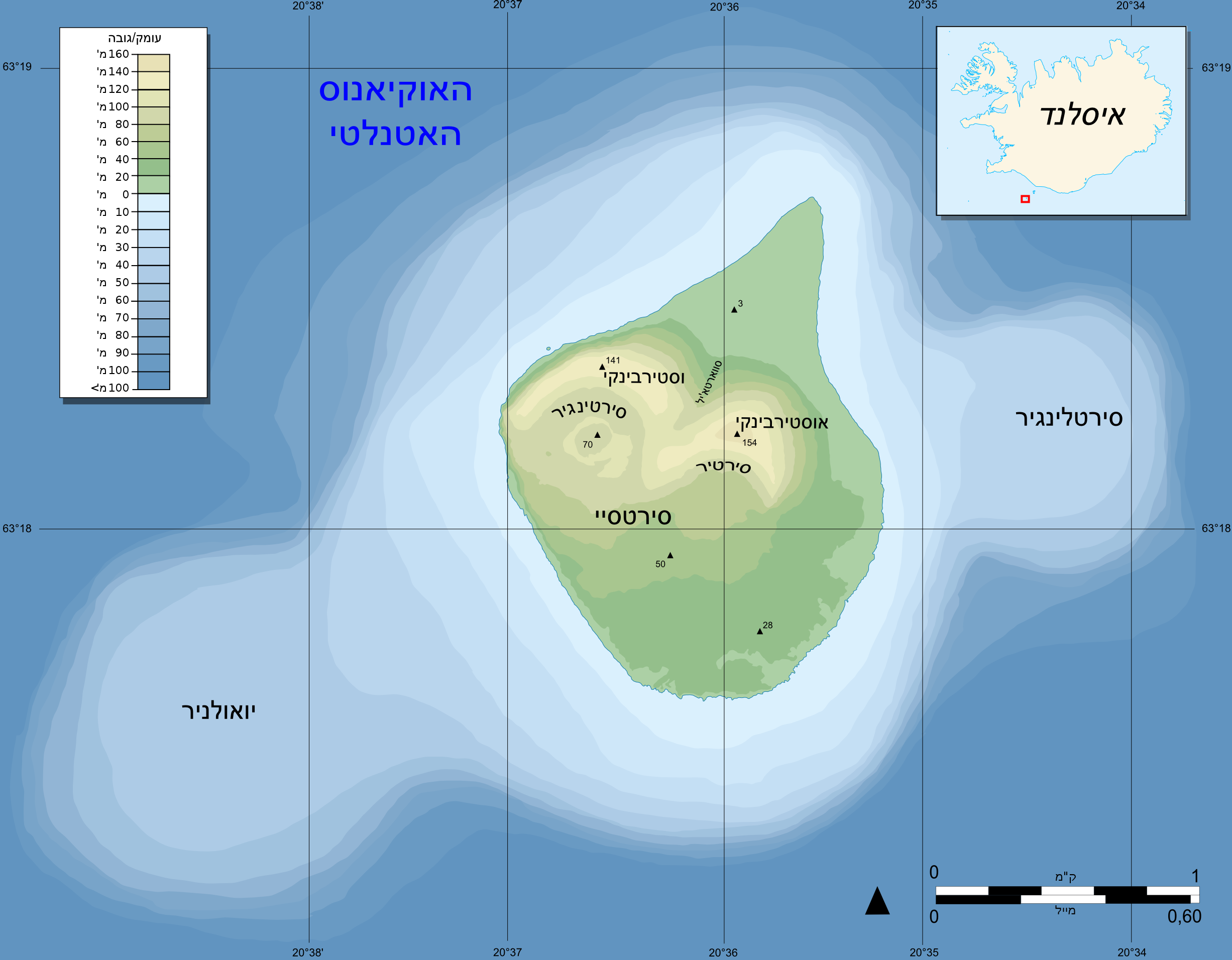
File:Topographic map of Surtsey-he.png
Size of this preview: 769 × 599 pixels. Other resolutions: 308 × 240 pixels | 616 × 480 pixels | 985 × 768 pixels | 1,280 × 998 pixels | 2,453 × 1,912 pixels.
Original file (2,453 × 1,912 pixels, file size: 443 KB, MIME type: image/png)
Captions
Captions
Add a one-line explanation of what this file represents
Summary edit

|
This file was moved to Wikimedia Commons from he.wikipedia using a bot script. All source information is still present. It requires review. Additionally, there may be errors in any or all of the information fields; information on this file should not be considered reliable and the file should not be used until it has been reviewed and any needed corrections have been made. Once the review has been completed, this template should be removed. For details about this file, see below. Check now! |
| Description |
עברית: גרסה עברית למקור |
| Date |
2009 |
| Source |
Transferred from he.wikipedia |
| Author |
Pinpin (עברית: משתמש:MT0). Original uploader was MT0 at he.wikipedia. Later version(s) were uploaded by GilCahana at he.wikipedia. |
| Permission (Reusing this file) |
CC; CC-BY-SA-3.0; Released under the GNU Free Documentation License. |
Licensing edit
I, the copyright holder of this work, hereby publish it under the following licenses:

|
Permission is granted to copy, distribute and/or modify this document under the terms of the GNU Free Documentation License, Version 1.2 or any later version published by the Free Software Foundation; with no Invariant Sections, no Front-Cover Texts, and no Back-Cover Texts. A copy of the license is included in the section entitled GNU Free Documentation License. |
This file is licensed under the Creative Commons Attribution-Share Alike 3.0 Unported license.
- You are free:
- to share – to copy, distribute and transmit the work
- to remix – to adapt the work
- Under the following conditions:
- attribution – You must give appropriate credit, provide a link to the license, and indicate if changes were made. You may do so in any reasonable manner, but not in any way that suggests the licensor endorses you or your use.
- share alike – If you remix, transform, or build upon the material, you must distribute your contributions under the same or compatible license as the original.
You may select the license of your choice.
Original upload log edit
The original description page was here. All following user names refer to he.wikipedia.
- 2009-07-17 15:55 GilCahana 2453×1912× (453170 bytes)
- 2009-07-16 21:49 GilCahana 2453×1912× (453935 bytes)
- 2009-07-14 05:16 MT0 2453×1912× (498358 bytes) {{מידע| |תיאור=גרסה עברית למקור |מקור=[http://commons.wikimedia.org/wiki/File:Topographic_map_of_Surtsey-fr.svg] |תאריך יצירה=2009 |יוצר=Pinpin (עברית: [[משתמש:MT0]]) |אישורים והיתרים= |גר
File history
Click on a date/time to view the file as it appeared at that time.
| Date/Time | Thumbnail | Dimensions | User | Comment | |
|---|---|---|---|---|---|
| current | 11:18, 6 January 2012 | | 2,453 × 1,912 (443 KB) | Matanya (talk | contribs) | {{BotMoveToCommons|he.wikipedia|year={{subst:CURRENTYEAR}}|month={{subst:CURRENTMONTHNAME}}|day={{subst:CURRENTDAY}}}} {{Information |Description={{he|גרסה עברית למקור}} |Source=Transferred from [http://he.wikipedia.org he.wikipedia]<br/> |
You cannot overwrite this file.
File usage on Commons
There are no pages that use this file.
File usage on other wikis
The following other wikis use this file:
- Usage on he.wikipedia.org