File:Topographical map of the districts of Quebec, Three Rivers, St.Francis and Gaspe, Lower Canada - C.PNG

Size of this preview: 800 × 444 pixels. Other resolutions: 320 × 178 pixels | 640 × 355 pixels | 1,024 × 569 pixels | 1,280 × 711 pixels | 2,560 × 1,421 pixels | 5,012 × 2,783 pixels.
Original file (5,012 × 2,783 pixels, file size: 29.12 MB, MIME type: image/png)
Captions
Captions
Add a one-line explanation of what this file represents
Summary
edit
| Description |
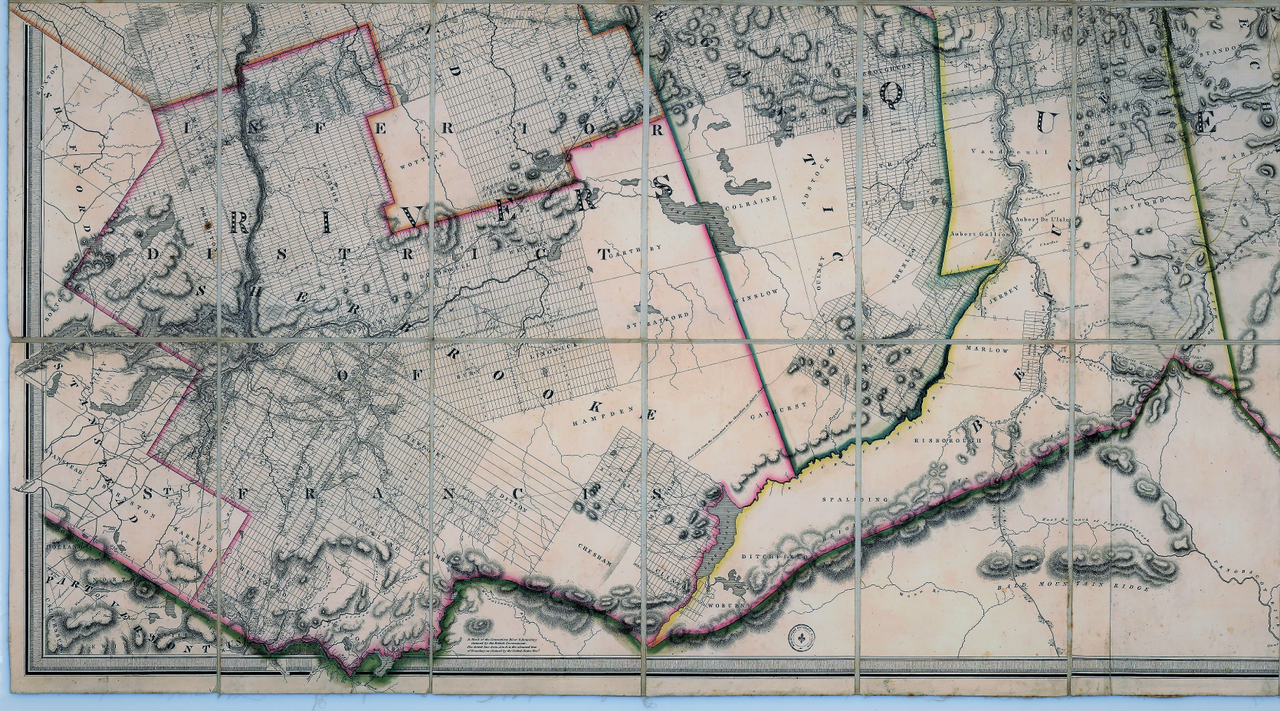
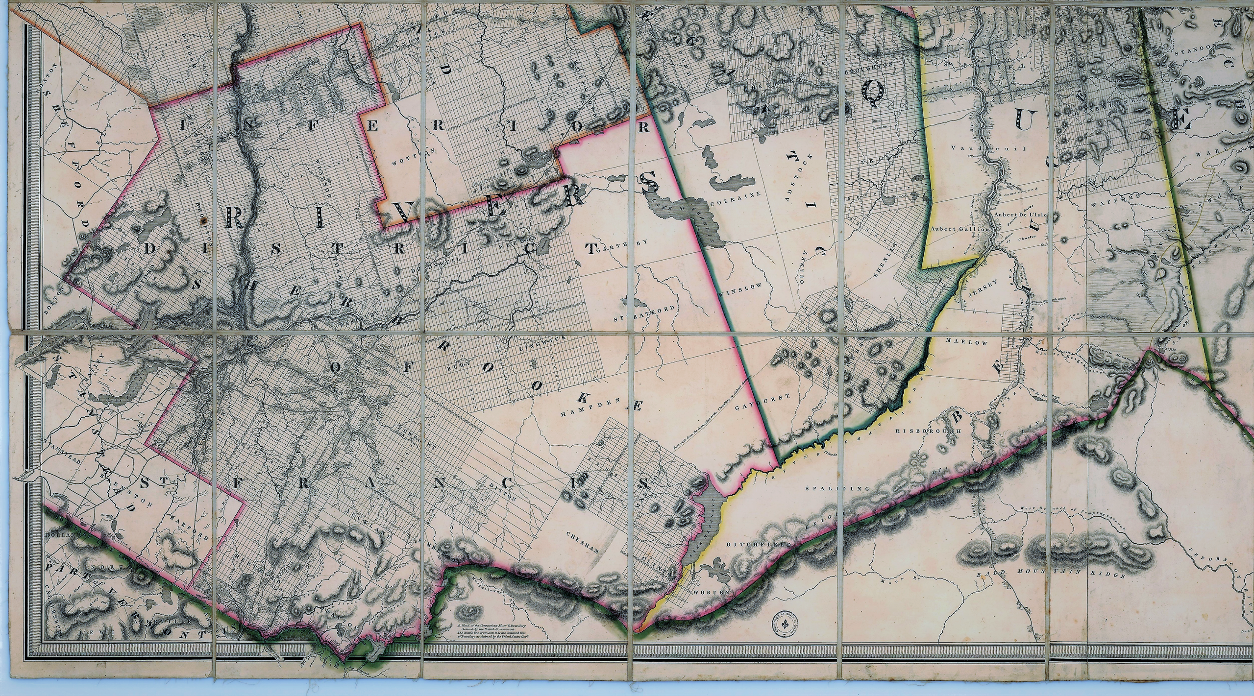
English: To his most Excellent Majesty, King William IV. This topographical map of the districts of Quebec, Three Rivers, St.Francis and Gaspé, Lower Canada : exhibiting the new civil division of the districts into counties pursuant to a recent Act of the provincial legislature; is with his Majesty's gracious and special permission, most humbly and gratefully dedicated by his Majesty's most devoted and loyal Canadian subject
Français : 1 carte : coul., entoilée ; sur feuille 129 x 234 cm pliée 32 x 20 cm dans un emboîtage de 36 x 23 cm |
| Date | |
| Source | http://services.banq.qc.ca/sdx/cep/document.xsp?id=0000090117 |
| Author | Joseph Bouchette |
Licensing
edit
|
This work is in the public domain in its country of origin and other countries and areas where the copyright term is the author's life plus 100 years or fewer. | |
| This file has been identified as being free of known restrictions under copyright law, including all related and neighboring rights. | |
File history
Click on a date/time to view the file as it appeared at that time.
| Date/Time | Thumbnail | Dimensions | User | Comment | |
|---|---|---|---|---|---|
| current | 00:39, 23 March 2018 | | 5,012 × 2,783 (29.12 MB) | Jeangagnon (talk | contribs) | teinte |
| 23:27, 14 March 2013 |  | 5,012 × 2,783 (27 MB) | Jeangagnon (talk | contribs) | {{Information |Description ={{en|1=.}} {{fr|1=.}} |Source =. |Author =. |Date =. |Permission = |other_versions = }} Category:Joseph Bouchette |
You cannot overwrite this file.
File usage on Commons
The following page uses this file:
File usage on other wikis
The following other wikis use this file:
- Usage on fr.wikipedia.org
- Usage on www.wikidata.org