File:Topographicalmapsiegeofcopenhagen1807.jpg

Original file (1,893 × 1,452 pixels, file size: 2.63 MB, MIME type: image/jpeg)
Captions
Captions
Summary edit
| DescriptionTopographicalmapsiegeofcopenhagen1807.jpg |
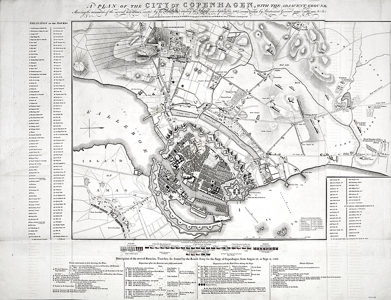
English: A detailed topographical map of Copenhagen and its surroundings showing the layout of the city and the British positions during the siege which lasted from 23 August to 6 September 1807.
The siege of Copenhagen was also known as the Second Battle of Copenhagen, or, the Bombardment of Copenhagen. During the siege, Copenhagen was burnt by an attack in which the British used over 14,000 missiles, including about 300 Congreve Rockets. The result of the siege was that the Danish navy surrendered to the British. From the collection of military and naval maps and prints of George III (1738-1820) |
| Date | |
| Source | militarymaps.rct.uk |
| Author | William Faden (1 July 1749-21 March 1836) (publisher) [top, below title, outside border |
Licensing edit
| Public domainPublic domainfalsefalse |
|
This work is in the public domain in its country of origin and other countries and areas where the copyright term is the author's life plus 70 years or fewer. This work is in the public domain in the United States because it was published (or registered with the U.S. Copyright Office) before January 1, 1929. | |
| This file has been identified as being free of known restrictions under copyright law, including all related and neighboring rights. | |
https://creativecommons.org/publicdomain/mark/1.0/PDMCreative Commons Public Domain Mark 1.0falsefalse
File history
Click on a date/time to view the file as it appeared at that time.
| Date/Time | Thumbnail | Dimensions | User | Comment | |
|---|---|---|---|---|---|
| current | 16:15, 9 July 2020 |  | 1,893 × 1,452 (2.63 MB) | 0m9Ep (talk | contribs) | Brightness, color |
| 01:34, 29 January 2020 |  | 1,893 × 1,452 (2.12 MB) | Aeengath (talk | contribs) | User created page with UploadWizard |
You cannot overwrite this file.
File usage on Commons
There are no pages that use this file.
File usage on other wikis
The following other wikis use this file:
- Usage on en.wikipedia.org
Metadata
This file contains additional information such as Exif metadata which may have been added by the digital camera, scanner, or software program used to create or digitize it. If the file has been modified from its original state, some details such as the timestamp may not fully reflect those of the original file. The timestamp is only as accurate as the clock in the camera, and it may be completely wrong.
| Image title |
|
|---|---|
| Copyright holder |
|
| ISO speed rating | 50 |
| Date and time of data generation | 00:00, 22 March 2017 |
| Label | Approved |
| Orientation | Normal |
| Horizontal resolution | 300 dpi |
| Vertical resolution | 300 dpi |
| Software used | Adobe Photoshop 21.0 (Macintosh) |
| File change date and time | 20:29, 28 January 2020 |
| Exif version | 2.31 |
| Date and time of digitizing | 10:11, 22 March 2017 |
| Color space | Uncalibrated |
| Date metadata was last modified | 15:29, 28 January 2020 |
| Copyright status | Copyrighted |
| Unique ID of original document | xmp.did:f01644dc-dfec-4664-bc0a-6e760d77d198 |
| Contact information | info@toddwhite.co.uk
3 Clifford Street London, , W1S 2LF England |
| IIM version | 2 |