File:Topographische Karte über das Grossherzogthum Baden Blatt 03 Waldleiningen.jpg

Original file (2,768 × 2,924 pixels, file size: 1.56 MB, MIME type: image/jpeg)
Captions
Captions
Summary
edit
| Description |
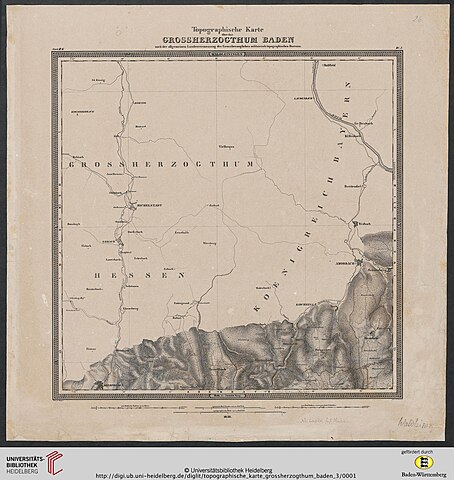
Deutsch: Baden / Topographisches Bureau [Hrsg.]; Mayer, V. [Red.]; Winckens, W. [Bearb.]
Topographische Karte über das Grossherzogthum Baden: nach der allgemeinen Landesvermessung des Großherzoglichen militairisch topographischen Bureaus (Blatt 3): Waldleiningen — Karlsruhe, 1838 |
| Date | circa 1838 |
| Source | https://digi.ub.uni-heidelberg.de/diglit/topographische_karte_grossherzogthum_baden_3 |
| Author | Baden / Topographisches Bureau [Hrsg.]; Mayer, V. [Red.]; Winckens, W. [Bearb.] |
| Permission (Reusing this file) |
https://digi.ub.uni-heidelberg.de/diglit/topographische_karte_grossherzogthum_baden_3 |
Licensing
edit
|
This work is in the public domain in its country of origin and other countries and areas where the copyright term is the author's life plus 70 years or fewer.
| |
| This file has been identified as being free of known restrictions under copyright law, including all related and neighboring rights. | |
File history
Click on a date/time to view the file as it appeared at that time.
| Date/Time | Thumbnail | Dimensions | User | Comment | |
|---|---|---|---|---|---|
| current | 10:50, 24 August 2020 | | 2,768 × 2,924 (1.56 MB) | Granpar (talk | contribs) | {{Information |description ={{de|1=Baden / Topographisches Bureau [Hrsg.]; Mayer, V. [Red.]; Winckens, W. [Bearb.] Topographische Karte über das Grossherzogthum Baden: nach der allgemeinen Landesvermessung des Großherzoglichen militairisch topographischen Bureaus (Blatt 3): Waldleiningen — Karlsruhe, 1838}} |date =~1838 |source =https://digi.ub.uni-heidelberg.de/diglit/topographische_karte_grossherzogthum_baden_3 |author =Baden / Topographisches Bureau [Hrsg.]; Maye... |
You cannot overwrite this file.
File usage on Commons
The following page uses this file: