File:Topol village 074.jpg
Size of this preview: 800 × 437 pixels. Other resolutions: 320 × 175 pixels | 640 × 350 pixels | 1,024 × 559 pixels | 1,280 × 699 pixels | 2,560 × 1,398 pixels.
Original file (2,560 × 1,398 pixels, file size: 2.15 MB, MIME type: image/jpeg)
File information
Structured data
Captions
Summary
editDescriptionTopol village 074.jpg |
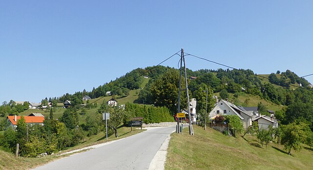
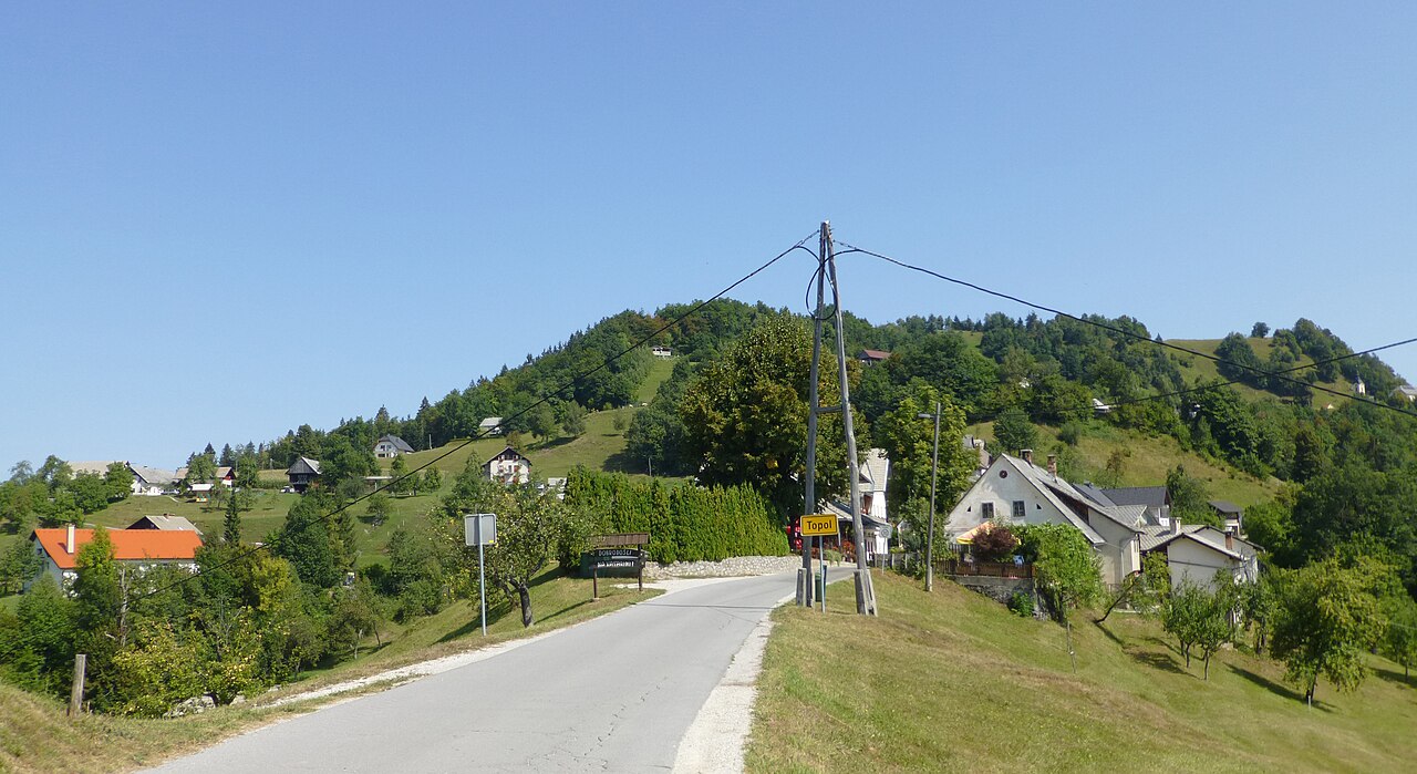
English: Village entry at Topol pri Medvodah, west of Ljubljana. Upper Carniola landscape. |
Date | |
Source | Own work |
Author | Jacquesverlaeken |
Camera location | 46° 05′ 29.37″ N, 14° 22′ 09.92″ E | View this and other nearby images on: OpenStreetMap | 46.091492; 14.369422 |
---|
Licensing
editI, the copyright holder of this work, hereby publish it under the following license:
This file is licensed under the Creative Commons Attribution-Share Alike 4.0 International license.
- You are free:
- to share – to copy, distribute and transmit the work
- to remix – to adapt the work
- Under the following conditions:
- attribution – You must give appropriate credit, provide a link to the license, and indicate if changes were made. You may do so in any reasonable manner, but not in any way that suggests the licensor endorses you or your use.
- share alike – If you remix, transform, or build upon the material, you must distribute your contributions under the same or compatible license as the original.
File history
Click on a date/time to view the file as it appeared at that time.
Date/Time | Thumbnail | Dimensions | User | Comment | |
---|---|---|---|---|---|
current | 20:09, 17 September 2018 | 2,560 × 1,398 (2.15 MB) | Jacquesverlaeken (talk | contribs) | User created page with UploadWizard |
You cannot overwrite this file.
File usage on Commons
There are no pages that use this file.
Metadata
This file contains additional information such as Exif metadata which may have been added by the digital camera, scanner, or software program used to create or digitize it. If the file has been modified from its original state, some details such as the timestamp may not fully reflect those of the original file. The timestamp is only as accurate as the clock in the camera, and it may be completely wrong.
Camera manufacturer | Panasonic |
---|---|
Camera model | DMC-TZ30 |
Exposure time | 1/1,000 sec (0.001) |
F-number | f/3.6 |
ISO speed rating | 100 |
Date and time of data generation | 11:27, 28 August 2018 |
Lens focal length | 5.4 mm |
Latitude | 46° 5′ 29.37″ N |
Longitude | 14° 22′ 9.92″ E |
Orientation | Normal |
Horizontal resolution | 180 dpi |
Vertical resolution | 180 dpi |
Software used | Adobe Photoshop Elements 6.0 Windows |
File change date and time | 21:53, 17 September 2018 |
Y and C positioning | Co-sited |
Exposure Program | Portrait mode (for closeup photos with the background out of focus) |
Exif version | 2.3 |
Date and time of digitizing | 11:27, 28 August 2018 |
Meaning of each component |
|
Image compression mode | 4 |
APEX exposure bias | 0 |
Maximum land aperture | 3.6953125 APEX (f/3.6) |
Metering mode | Pattern |
Light source | Flash |
Flash | Flash fired, compulsory flash firing |
Supported Flashpix version | 1 |
Color space | sRGB |
Sensing method | One-chip color area sensor |
File source | Digital still camera |
Scene type | A directly photographed image |
Custom image processing | Normal process |
Exposure mode | Auto exposure |
White balance | Auto white balance |
Digital zoom ratio | 0 |
Focal length in 35 mm film | 30 mm |
Scene capture type | Portrait |
Scene control | None |
Contrast | Normal |
Saturation | Normal |
Sharpness | Normal |
GPS time (atomic clock) | 09:25 |
Receiver status | Measurement in progress |
Measurement mode | 2-dimensional measurement |
Measurement precision | Fair (1.5) |
Geodetic survey data used | WGS-84 |
Name of GPS area | Topol pri Medvodah |
GPS date | 28 August 2018 |
GPS tag version | 0.0.3.2 |
Supported Flashpix version | 1 |
Image width | 2,560 px |
Image height | 1,398 px |
Date metadata was last modified | 23:53, 17 September 2018 |
IIM version | 18,401 |