File:Torino location map blank.PNG

Size of this preview: 535 × 599 pixels. Other resolutions: 214 × 240 pixels | 428 × 480 pixels | 689 × 772 pixels.
Original file (689 × 772 pixels, file size: 28 KB, MIME type: image/png)
Captions
Captions
Add a one-line explanation of what this file represents
Summary
edit
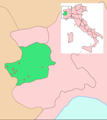
Location map of Torino and other venues and nearby areas for the 2006 Winter Olympics. The Italian province of Turin is shown in green. For a map with descriptions written on the map in English, see Image:Torino location map winter olympics.PNG
Licensing
edit
I, the copyright holder of this work, hereby publish it under the following license:

|
Permission is granted to copy, distribute and/or modify this document under the terms of the GNU Free Documentation License, Version 1.2 or any later version published by the Free Software Foundation; with no Invariant Sections, no Front-Cover Texts, and no Back-Cover Texts. A copy of the license is included in the section entitled GNU Free Documentation License. |
| This file is licensed under the Creative Commons Attribution-Share Alike 3.0 Unported license. | ||
| ||
| This licensing tag was added to this file as part of the GFDL licensing update. |
File history
Click on a date/time to view the file as it appeared at that time.
| Date/Time | Thumbnail | Dimensions | User | Comment | |
|---|---|---|---|---|---|
| current | 02:05, 21 February 2006 | | 689 × 772 (28 KB) | Roke~commonswiki (talk | contribs) | Location map of Torino and other venues and nearby areas for the 2006 Winter Olympics. For a map with descriptions written on the map in English, see Image:Torino location map winter olympics.PNG |
You cannot overwrite this file.
File usage on Commons
There are no pages that use this file.