File:Towada Caldera 3D 2012.jpg

Size of this preview: 631 × 599 pixels. Other resolutions: 253 × 240 pixels | 505 × 480 pixels | 808 × 768 pixels | 1,200 × 1,140 pixels.
Original file (1,200 × 1,140 pixels, file size: 870 KB, MIME type: image/jpeg)
Captions
Captions
Add a one-line explanation of what this file represents
Summary
edit
| Description |
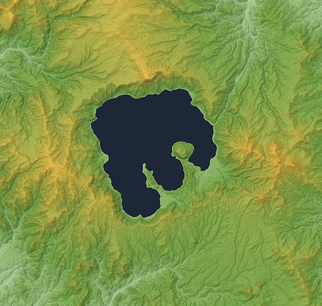
English: Lake Towada and Towada Caldera in the border between Aomori and Akita Prefectures,Honshu, Japan. This file updated by 30m Mesh.
|
| Date | |
| Source |
Topographic data: NASA's SRTM-1 30m Mesh (ver.3 2014) |
| Author | Batholith |
| Object location | | View this and other nearby images on: OpenStreetMap |
|---|
Licensing
edit
| I, the copyright holder of this work, release this work into the public domain. This applies worldwide. In some countries this may not be legally possible; if so: I grant anyone the right to use this work for any purpose, without any conditions, unless such conditions are required by law. |
This image uses high-resolution digital topography data from NASA's Shuttle Radar Topography Mission (SRTM) at JPL-Caltech [1]. It is in the public domain in the United States.
|
 | |
File history
Click on a date/time to view the file as it appeared at that time.
| Date/Time | Thumbnail | Dimensions | User | Comment | |
|---|---|---|---|---|---|
| current | 03:35, 28 February 2016 | | 1,200 × 1,140 (870 KB) | Batholith (talk | contribs) | This file updated to 30m Mesh (SRTM-1 Ver3 2014). |
| 16:25, 9 November 2012 |  | 400 × 380 (115 KB) | Batholith (talk | contribs) | == {{int:filedesc}} == {{Information |description= {{en|Lake Towada, Aomori Prefecture, Japan.}} {{ja|青森県の十和田湖および十和田カル�... |
You cannot overwrite this file.
File usage on Commons
The following 2 pages use this file:
File usage on other wikis
The following other wikis use this file:
- Usage on en.wikipedia.org
- Usage on es.wikipedia.org
- Usage on id.wikipedia.org
- Usage on ja.wikipedia.org
- Usage on my.wikipedia.org
- Usage on simple.wikipedia.org
- Usage on www.wikidata.org
- Usage on zh.wikipedia.org