File:Towards Cwm Dar - geograph.org.uk - 1018042.jpg
No higher resolution available.
Towards_Cwm_Dar_-_geograph.org.uk_-_1018042.jpg (640 × 427 pixels, file size: 166 KB, MIME type: image/jpeg)
Captions
Captions
Add a one-line explanation of what this file represents
Summary edit
| Description |
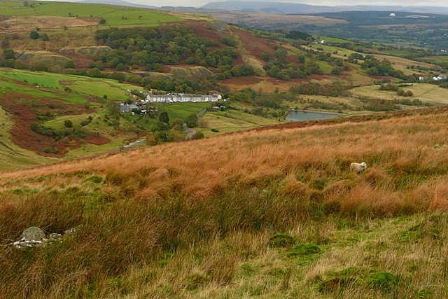
English: Towards Cwm Dar From the Coed Morgannwg Way path that crosses the north-western part of the square. The immediate locality is sheep grazing moorland before dropping steeper towards Cwm Dar. The higher of its two small reservoirs can be seen. |
| Date | |
| Source | From geograph.org.uk |
| Author | Graham Horn |
| Attribution (required by the license) | Graham Horn / Towards Cwm Dar / |
| Camera location | | View this and other nearby images on: OpenStreetMap |
|---|
_heading:22.00&language=en)
| Object location | | View this and other nearby images on: OpenStreetMap |
|---|
_heading:22.00&language=en)
Licensing edit

|
This image was taken from the Geograph project collection. See this photograph's page on the Geograph website for the photographer's contact details. The copyright on this image is owned by Graham Horn and is licensed for reuse under the Creative Commons Attribution-ShareAlike 2.0 license.
|
This file is licensed under the Creative Commons Attribution-Share Alike 2.0 Generic license.
Attribution: Graham Horn
- You are free:
- to share – to copy, distribute and transmit the work
- to remix – to adapt the work
- Under the following conditions:
- attribution – You must give appropriate credit, provide a link to the license, and indicate if changes were made. You may do so in any reasonable manner, but not in any way that suggests the licensor endorses you or your use.
- share alike – If you remix, transform, or build upon the material, you must distribute your contributions under the same or compatible license as the original.
File history
Click on a date/time to view the file as it appeared at that time.
| Date/Time | Thumbnail | Dimensions | User | Comment | |
|---|---|---|---|---|---|
| current | 12:19, 23 February 2011 | | 640 × 427 (166 KB) | GeographBot (talk | contribs) | == {{int:filedesc}} == {{Information |description={{en|1=Towards Cwm Dar From the Coed Morgannwg Way path that crosses the north-western part of the square. The immediate locality is sheep grazing moorland before dropping steeper towards Cwm Dar. The hi |
You cannot overwrite this file.
File usage on Commons
There are no pages that use this file.