File:Tower section passing Whittle Hill - geograph.org.uk - 764171.jpg
No higher resolution available.
Tower_section_passing_Whittle_Hill_-_geograph.org.uk_-_764171.jpg (640 × 480 pixels, file size: 46 KB, MIME type: image/jpeg)
Captions
Captions
Add a one-line explanation of what this file represents
Summary edit
| Description |
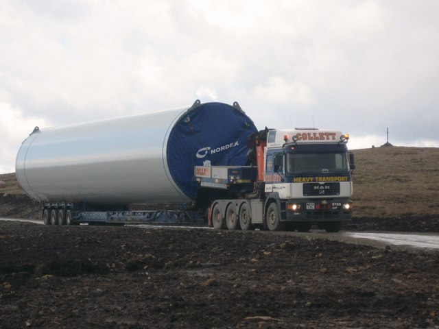
English: Tower section passing Whittle Hill. A lowloader, carrying the middle 22 metre 54 ton section for turbine tower No 5, passes Whittle Hill.
A total of eight miles of access roads have been built on Scout Moor to allow the delivery and construction of the Scout Moor Wind Farm. The cross on top of the hill on the right is 490951 696211 633643 696917 696963 762891 754173 Turbine details: Tower Height: 60m Blade Length: 40m Total Max Height: 100m Manufacturer: Nordex Model: N80 collett heavy transport |
| Date | |
| Source | From geograph.org.uk |
| Author | Paul Anderson |
| Attribution (required by the license) | Paul Anderson / Tower section passing Whittle Hill / |
| Camera location | | View this and other nearby images on: OpenStreetMap |
|---|
_heading:292.00&language=en)
| Object location | | View this and other nearby images on: OpenStreetMap |
|---|
_heading:292.00&language=en)
Licensing edit

|
This image was taken from the Geograph project collection. See this photograph's page on the Geograph website for the photographer's contact details. The copyright on this image is owned by Paul Anderson and is licensed for reuse under the Creative Commons Attribution-ShareAlike 2.0 license.
|
This file is licensed under the Creative Commons Attribution-Share Alike 2.0 Generic license.
Attribution: Paul Anderson
- You are free:
- to share – to copy, distribute and transmit the work
- to remix – to adapt the work
- Under the following conditions:
- attribution – You must give appropriate credit, provide a link to the license, and indicate if changes were made. You may do so in any reasonable manner, but not in any way that suggests the licensor endorses you or your use.
- share alike – If you remix, transform, or build upon the material, you must distribute your contributions under the same or compatible license as the original.
File history
Click on a date/time to view the file as it appeared at that time.
| Date/Time | Thumbnail | Dimensions | User | Comment | |
|---|---|---|---|---|---|
| current | 20:01, 19 February 2011 | | 640 × 480 (46 KB) | GeographBot (talk | contribs) | == {{int:filedesc}} == {{Information |description={{en|1=Tower section passing Whittle Hill A lowloader, carrying the middle 22 metre 54 ton section for turbine tower No 5, passes Whittle Hill. A total of eight miles of access roads have been built on Sc |
You cannot overwrite this file.
File usage on Commons
There are no pages that use this file.