File:Tropical Cyclone Eloise (MODIS 2021-01-20).jpg

Size of this preview: 720 × 600 pixels. Other resolutions: 288 × 240 pixels | 577 × 480 pixels | 922 × 768 pixels | 1,230 × 1,024 pixels | 2,460 × 2,048 pixels | 7,822 × 6,513 pixels.
Original file (7,822 × 6,513 pixels, file size: 4.49 MB, MIME type: image/jpeg)
Captions
Captions
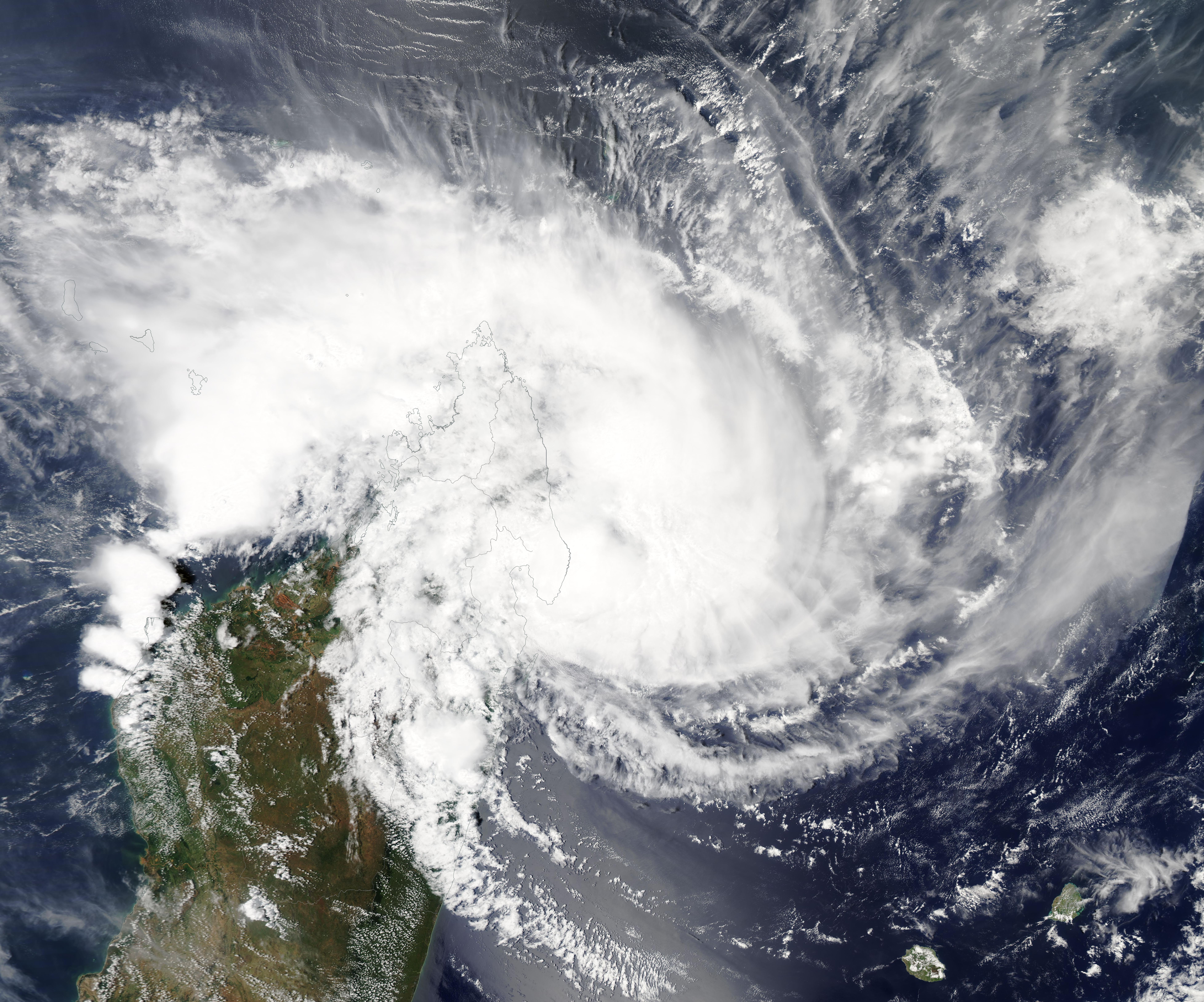
Tropical Cyclone Eloise was nearing landfall over north-eastern Madagascar on January 19, 2021 when the Moderate Resolution Imaging Spectroradiometer (MODIS) on board NASA’s Aqua satellite acquired a true-color image of the storm.
Summary edit
.jpg&action=edit§ion=1)
| Description |
English: Tropical Cyclone Eloise was nearing landfall over north-eastern Madagascar on January 19, 2021 when the Moderate Resolution Imaging Spectroradiometer (MODIS) on board NASA’s Aqua satellite acquired a true-color image of the storm. Shortly after this image was captured, Eloise crossed land just south of the town of Antalahala bearing maximum sustained winds of approximately 83.5 km/h (51 mph).
Although categorized as tropical storm at the time of landfall, Eloise is being called a “dangerous system” both for the heavy rain it carries and for its predicted behavior later in the week. According to the United Nations Office for the Coordination of Humanitarian Affairs (OCHA), the storm may generate heavy rains that may last for more than 24 hours and carries strong winds. These rains may generate floods and landslides. After landfall, Tropical Cyclone Eloise has continued weaken as it continues across Madagascar traveling towards the southeast. It is expected to re-emerge over the Mozambique Channel on January 21, where it will likely restrengthen before striking southern Mozambique on January 23. The Joint Typhoon Warning Center (JTWC) forecasts wind speeds of about 92 mph (148 km/h) before landfall are likely. This would make Eloise a strong Category 1 storm on the Saffir-Simpson Hurricane Wind Scale at that time. |
||
| Date | Taken on 19 January 2021 | ||
| Source |
Tropical Cyclone Eloise (direct link)
|
||
| Author | MODIS Land Rapid Response Team, NASA GSFC |
| This media is a product of the Aqua mission Credit and attribution belongs to the mission team, if not already specified in the "author" row |
Licensing edit
.jpg&action=edit§ion=2)
| This file is in the public domain in the United States because it was solely created by NASA. NASA copyright policy states that "NASA material is not protected by copyright unless noted". (See Template:PD-USGov, NASA copyright policy page or JPL Image Use Policy.) | ||
 |
Warnings:
|
File history
Click on a date/time to view the file as it appeared at that time.
| Date/Time | Thumbnail | Dimensions | User | Comment | |
|---|---|---|---|---|---|
| current | 18:06, 30 January 2024 | | 7,822 × 6,513 (4.49 MB) | OptimusPrimeBot (talk | contribs) | #Spacemedia - Upload of http://modis.gsfc.nasa.gov/gallery/images/image01202021_250m.jpg via Commons:Spacemedia |
You cannot overwrite this file.
File usage on Commons
There are no pages that use this file.
.jpg&oldid=847418135)