File:Tropical Cyclone Gina (MODIS 2022-05-20).jpg

Size of this preview: 764 × 600 pixels. Other resolutions: 306 × 240 pixels | 612 × 480 pixels | 979 × 768 pixels | 1,280 × 1,005 pixels | 2,560 × 2,009 pixels | 6,926 × 5,436 pixels.
Original file (6,926 × 5,436 pixels, file size: 4.25 MB, MIME type: image/jpeg)
Captions
Captions
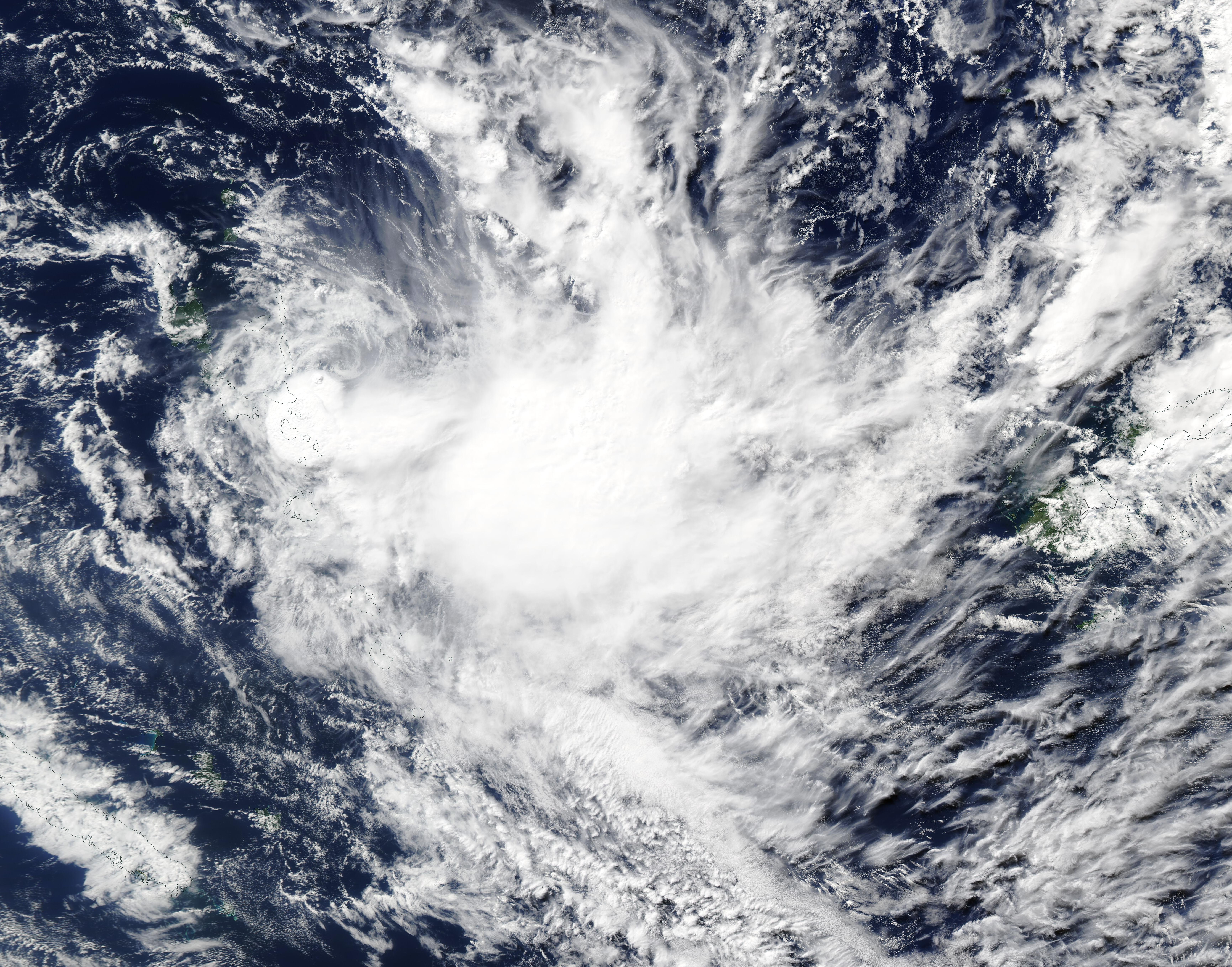
The Moderate Resolution Imaging Spectroradiometer (MODIS) on board NASA’s Aqua satellite acquired a true-color image of Tropical Cyclone Gina on May 19 when it was approaching the islands of Vanuatu, which can be southwest of the storm.
Summary
edit.jpg&action=edit§ion=1)
| Description |
English: On May 18, 2020, Tropical Cyclone Gina formed in the South Pacific Ocean east of Vanuatu. The sixth named storm of the 2021-2022 South Pacific tropical cyclone season, the storm actually is an out-of-season system, as the season started on November 1, 2021, and ended on April 30, 2022.
The Moderate Resolution Imaging Spectroradiometer (MODIS) on board NASA’s Aqua satellite acquired a true-color image of Tropical Cyclone Gina on May 19 when it was approaching the islands of Vanuatu, which can be southwest of the storm. Several islands of Fiji can be seen to the east. At the time the image was acquired, Tropical Cyclone Gina sported a large cloudy-filled eye with weak circulation around the center. At 2100 UTC (5:00 p.m. EDT) on May 19, the Joint Typhoon Warning Center (JTWC) reported Gina was carrying maximum sustained winds of 40 mph (64 km/h) with gusts to 53 mph (85 km/h) and was located approximately 36 miles (58 km) north-northwest of Port Villa, Vanuatu and was tracking south-southwestward. Maximum significant wave height is 14 feet (4.2 meter). Tropical Cyclone Gina is expected to maintain the current strength and motion over the next 36 hours and then will weaken and dissipate within 72 hours. While the system is carrying substantial rain, severe damage to land is not currently anticipated. |
||
| Date | Taken on 19 May 2022 | ||
| Source |
Tropical Cyclone Gina (direct link)
|
||
| Author | MODIS Land Rapid Response Team, NASA GSFC |
| This media is a product of the Aqua mission Credit and attribution belongs to the mission team, if not already specified in the "author" row |
Licensing
edit.jpg&action=edit§ion=2)
| This file is in the public domain in the United States because it was solely created by NASA. NASA copyright policy states that "NASA material is not protected by copyright unless noted". (See Template:PD-USGov, NASA copyright policy page or JPL Image Use Policy.) | ||
 |
Warnings:
|
File history
Click on a date/time to view the file as it appeared at that time.
| Date/Time | Thumbnail | Dimensions | User | Comment | |
|---|---|---|---|---|---|
| current | 22:04, 9 January 2024 | | 6,926 × 5,436 (4.25 MB) | OptimusPrimeBot (talk | contribs) | #Spacemedia - Upload of http://modis.gsfc.nasa.gov/gallery/images/image05202022_250m.jpg via Commons:Spacemedia |
You cannot overwrite this file.
File usage on Commons
There are no pages that use this file.
.jpg&oldid=865654121)