File:Tropical Cyclone Lucas (MODIS 2021-02-04).jpg

Original file (7,476 × 6,221 pixels, file size: 4.73 MB, MIME type: image/jpeg)
Captions
Captions
Summary
edit.jpg&action=edit§ion=1)
| Description |
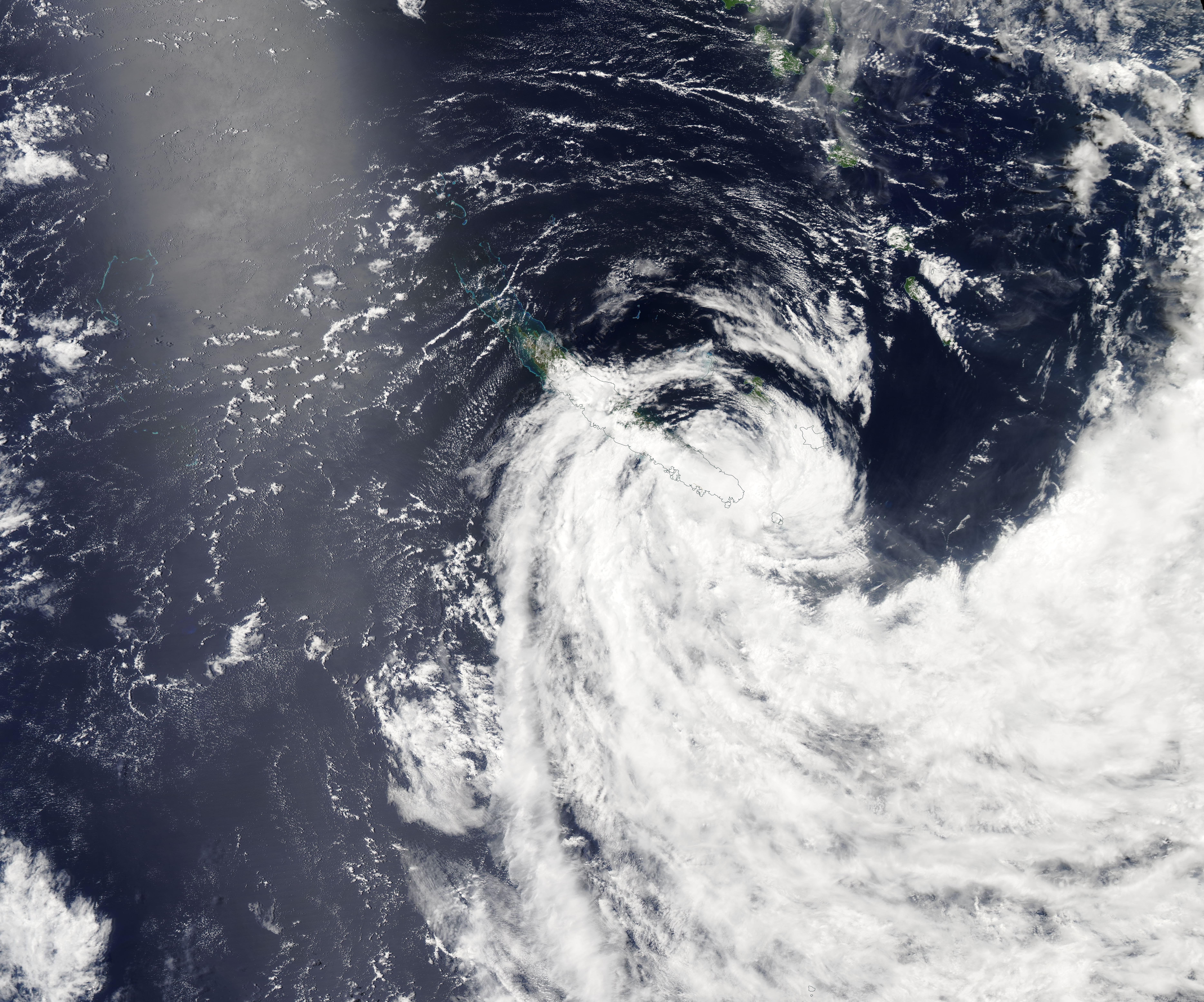
English: Tropical Cyclone Lucas whipped up winds and rain in New Caledonia in early February 2021. On February 2, the storm passed over Lifou Island, largest island in the Loyalty Islands Province of New Caledonia with maximum sustained winds of approximately 60 mph (96.5 km/h). Early assessments state that the tropical storm force winds damaged some houses and caused loss of power and phone services.
After leaving Lifou, Lucas took aim at Grande Terre, the largest island in New Caledonia. Tropical Cyclone Lucas clipped the southern tip of the island on February 3 carrying maximum sustained winds of about 74 km/h (46 mph). The Joint Typhoon Warning Center (JWTC) issued its final advisory on the system at 0300 UTC February 3 (10:00 p.m. EST on February 2). At that time, Lucas was still 65.6 miles (105 km) east-northeast of Noumea, Grande Terre Island, New Caledonia and was quickly becoming extratropical. It is forecast to dissipate in the Coral Sea but will be closely monitored for regeneration. The Moderate Resolution Imaging Spectroradiometer (MODIS) on board NASA’s Aqua satellite acquired a true-color image of Tropical Cyclone Lucas on February 3 as it passed over the southern end of Grande Terre. Although the storm still maintained circulation, it had lost symmetry and the center was poorly formed—all signs of a weak cyclone battered by wind shear. |
||
| Date | Taken on 3 February 2021 | ||
| Source |
Tropical Cyclone Lucas (direct link)
|
||
| Author | MODIS Land Rapid Response Team, NASA GSFC |
| This media is a product of the Aqua mission Credit and attribution belongs to the mission team, if not already specified in the "author" row |
Licensing
edit.jpg&action=edit§ion=2)
| This file is in the public domain in the United States because it was solely created by NASA. NASA copyright policy states that "NASA material is not protected by copyright unless noted". (See Template:PD-USGov, NASA copyright policy page or JPL Image Use Policy.) | ||
 |
Warnings:
|
File history
Click on a date/time to view the file as it appeared at that time.
| Date/Time | Thumbnail | Dimensions | User | Comment | |
|---|---|---|---|---|---|
| current | 18:03, 30 January 2024 | | 7,476 × 6,221 (4.73 MB) | OptimusPrimeBot (talk | contribs) | #Spacemedia - Upload of http://modis.gsfc.nasa.gov/gallery/images/image02042021_250m.jpg via Commons:Spacemedia |
You cannot overwrite this file.
File usage on Commons
There are no pages that use this file.
.jpg&oldid=847418164)