File:Tropical Storm Atsani (MODIS 2020-11-07).jpg

Original file (6,219 × 4,815 pixels, file size: 3.05 MB, MIME type: image/jpeg)
Captions
Captions
Summary
edit.jpg&action=edit§ion=1)
| Description |
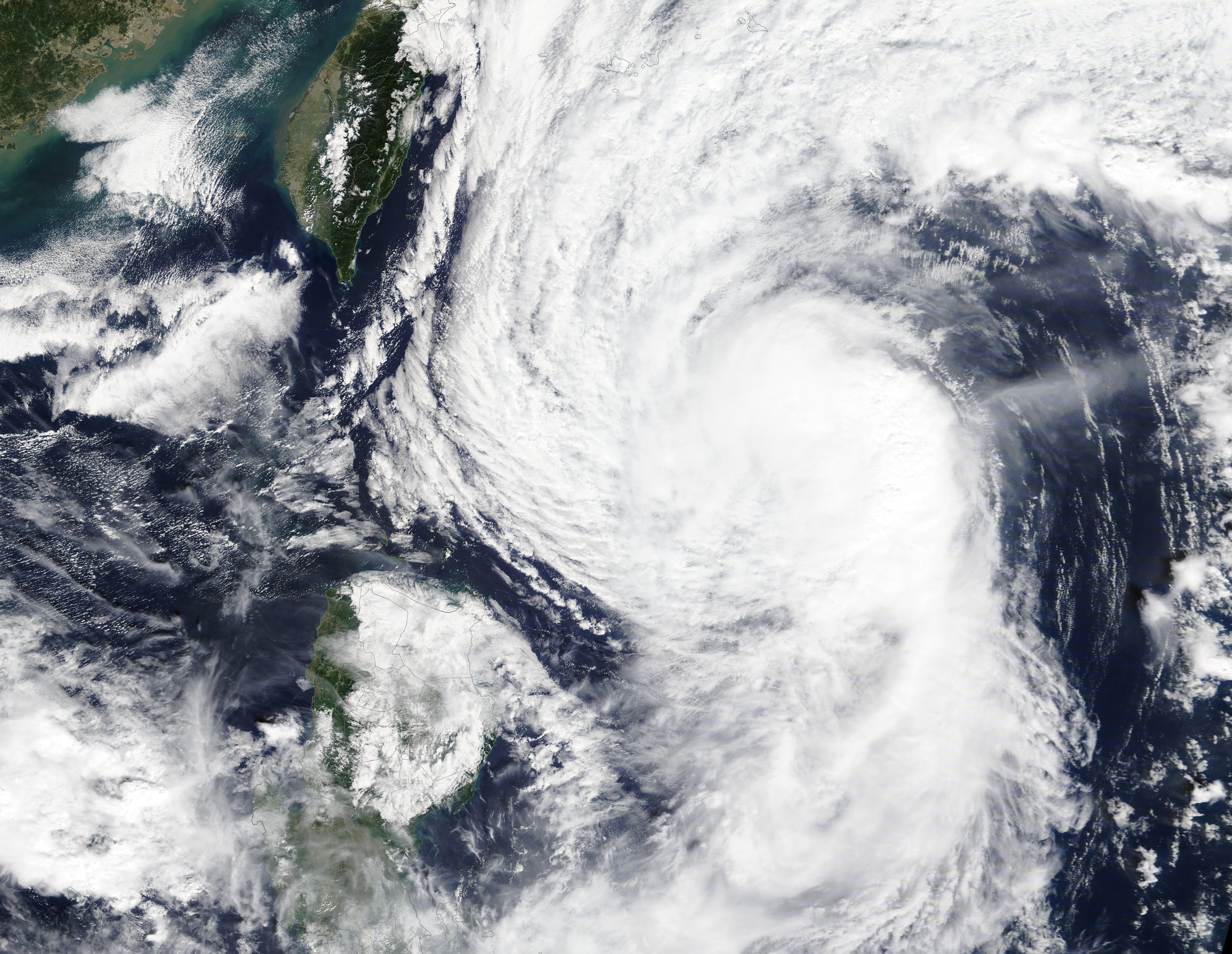
English: On November 5, 2020, Tropical Storm Atsani was spinning in the Philippine Sea east of Taiwan when the Moderate Resolution Imaging Spectroradiometer (MODIS) on board NASA’s Terra satellite acquired this true-color image. The asymmetric storm’s northwestern convective bands were just offshore of the island of Taiwan while the southwest quadrant remained offshore of the island of Luzon, Philippines.
At 12:00 UTC (7:00 a.m. EST) on November 5, Atsani carried maximum 1-minute sustained winds of 65 mph (130 km/h) and was located about 153 miles east of Itbayat, Philippines. According to the Philippine Atmospheric, Geophysical and Astronomical Services Administration (PAGASA), Tropical Storm Atsani (also known as Siony) made landfall on Misanga Island in Batanes province, Philippines, on the morning of November 6, carrying sustained winds of 95 km/h (59 mph) and gusts of up to 115 km/h (71.5 mph). Strong winds and rains have been reported in the Philippines, but no casualties from Atsani. It is the twentieth named storm of the 2020 Pacific typhoon season and the nineteenth storm to strike the Philippines this season. According to the Joint Typhoon Warning Center (JTWC) Tropical Storm Atsani is expected to continue tracking slowly west-northwestward through early November 7, after which it is expected to make a sharp southwestward turn as it weakens, then dissipates in the next few days. |
||
| Date | Taken on 5 November 2020 | ||
| Source |
Tropical Storm Atsani (direct link)
|
||
| Author | MODIS Land Rapid Response Team, NASA GSFC |
| This media is a product of the Terra mission Credit and attribution belongs to the mission team, if not already specified in the "author" row |
Licensing
edit.jpg&action=edit§ion=2)
| This file is in the public domain in the United States because it was solely created by NASA. NASA copyright policy states that "NASA material is not protected by copyright unless noted". (See Template:PD-USGov, NASA copyright policy page or JPL Image Use Policy.) | ||
 |
Warnings:
|
File history
Click on a date/time to view the file as it appeared at that time.
| Date/Time | Thumbnail | Dimensions | User | Comment | |
|---|---|---|---|---|---|
| current | 17:40, 4 February 2024 | | 6,219 × 4,815 (3.05 MB) | OptimusPrimeBot (talk | contribs) | #Spacemedia - Upload of http://modis.gsfc.nasa.gov/gallery/images/image11072020_250m.jpg via Commons:Spacemedia |
You cannot overwrite this file.
File usage on Commons
There are no pages that use this file.
.jpg&oldid=909385205)