File:Troyes - grands quartiers 2001 - map-fr.svg

Size of this PNG preview of this SVG file: 600 × 600 pixels. Other resolutions: 240 × 240 pixels | 480 × 480 pixels | 768 × 768 pixels | 1,024 × 1,024 pixels | 2,048 × 2,048 pixels | 750 × 750 pixels.
Original file (SVG file, nominally 750 × 750 pixels, file size: 52 KB)
Captions
Captions
Add a one-line explanation of what this file represents
Summary edit
| Description | |||
| Date | (UTC) | ||
| Source | Own work | ||
| Author | Sémhur (talk) | ||
| Other versions | |||
| Attribution (required by the license) | © Sémhur / Wikimedia Commons / | ||
| SVG | W3C-validity not checked.
|
||
| Graphic Lab |

| Camera location | | View this and other nearby images on: OpenStreetMap |
|---|
Licensing edit
I, the copyright holder of this work, hereby publish it under the following licenses:
| Copyleft: This work of art is free; you can redistribute it and/or modify it according to terms of the Free Art License. You will find a specimen of this license on the Copyleft Attitude site as well as on other sites. |
This file is licensed under the Creative Commons Attribution-Share Alike 4.0 International, 3.0 Unported, 2.5 Generic, 2.0 Generic and 1.0 Generic license.
- You are free:
- to share – to copy, distribute and transmit the work
- to remix – to adapt the work
- Under the following conditions:
- attribution – You must give appropriate credit, provide a link to the license, and indicate if changes were made. You may do so in any reasonable manner, but not in any way that suggests the licensor endorses you or your use.
- share alike – If you remix, transform, or build upon the material, you must distribute your contributions under the same or compatible license as the original.
You may select the license of your choice.
File history
Click on a date/time to view the file as it appeared at that time.
| Date/Time | Thumbnail | Dimensions | User | Comment | |
|---|---|---|---|---|---|
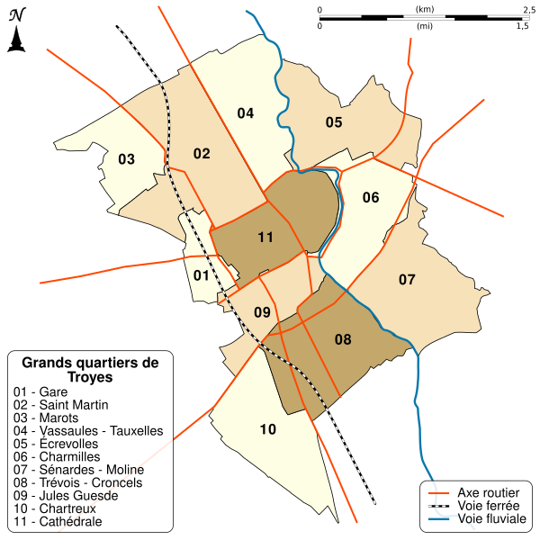
| current | 15:58, 23 February 2011 | | 750 × 750 (52 KB) | Sémhur (talk | contribs) | == {{int:filedesc}} == {{Information |Description={{Multilingual description |en= Map of great district of Troyes, Aube, Champagne-Ardenne, France, in 2001. |fr= Carte des grands quartiers de Troyes, Aube, Champagne-Ardenne, |
You cannot overwrite this file.
File usage on Commons
There are no pages that use this file.
File usage on other wikis
The following other wikis use this file:
- Usage on fr.wikipedia.org
- Troyes
- Stade de l'Aube
- Hôtel du Lion noir
- Hôtel de Marisy
- Institut universitaire de technologie de Troyes
- Maison de l'outil et de la pensée ouvrière
- Musée de Vauluisant
- Musée Saint-Loup
- Musée d'Art moderne de Troyes
- Commanderie de Troyes
- Hôtel de préfecture de l'Aube
- Les Sénardes
- Abbaye Saint-Loup de Troyes
- Hôtel de Mauroy
- Wikipédia:Atelier graphique/Cartes/Archives/février 2011
- Église Saint-Martin-ès-Vignes de Troyes
- Église Saint-Nicolas de Troyes
- Hôtel de Chapelaines
- Lycée Chrestien-de-Troyes
- Église Saint-Jean-du-Marché de Troyes
- Rue Émile-Zola (Troyes)
- Médiathèque Jacques-Chirac
- Église de la Madeleine de Troyes
- Église Saint-Pantaléon de Troyes
- Maison de l'Orfèvre
- Hôtel du Petit Louvre
- Église Notre-Dame des Trévois
- Hôtel des Ursins
- Maison de l'Élection
- Hôtel-Dieu-le-Comte de Troyes
- Hospice Saint-Nicolas de Troyes
- Abbaye Saint-Martin-ès-Aires
- Hôtel Deheurles
- Rue Champeaux
- Abbaye Notre-Dame-aux-Nonnains
- Collégiale Saint-Étienne de Troyes
- Ancien cimetière de l'église de la Madeleine
- Cirque municipal de Troyes
- Couvent des Cordeliers de Troyes
- Château des comtes de Champagne
- Ancien château des comtes de Champagne
- Collège Pierre-et-François-Pithou
- Rue Molé
- Rue Urbain-IV
- Rue de la Madeleine (Troyes)
- Rue Turenne (Troyes)
- Rue de la Monnaie (Troyes)
- Moulin du Roy
- Moulin de la Moline
- Hôtel de l'Arquebuse
View more global usage of this file.