File:Trute map pt.svg

Size of this PNG preview of this SVG file: 800 × 594 pixels. Other resolutions: 320 × 238 pixels | 640 × 475 pixels | 1,024 × 761 pixels | 1,280 × 951 pixels | 2,560 × 1,902 pixels | 2,470 × 1,835 pixels.
Original file (SVG file, nominally 2,470 × 1,835 pixels, file size: 233 KB)
Captions
Captions
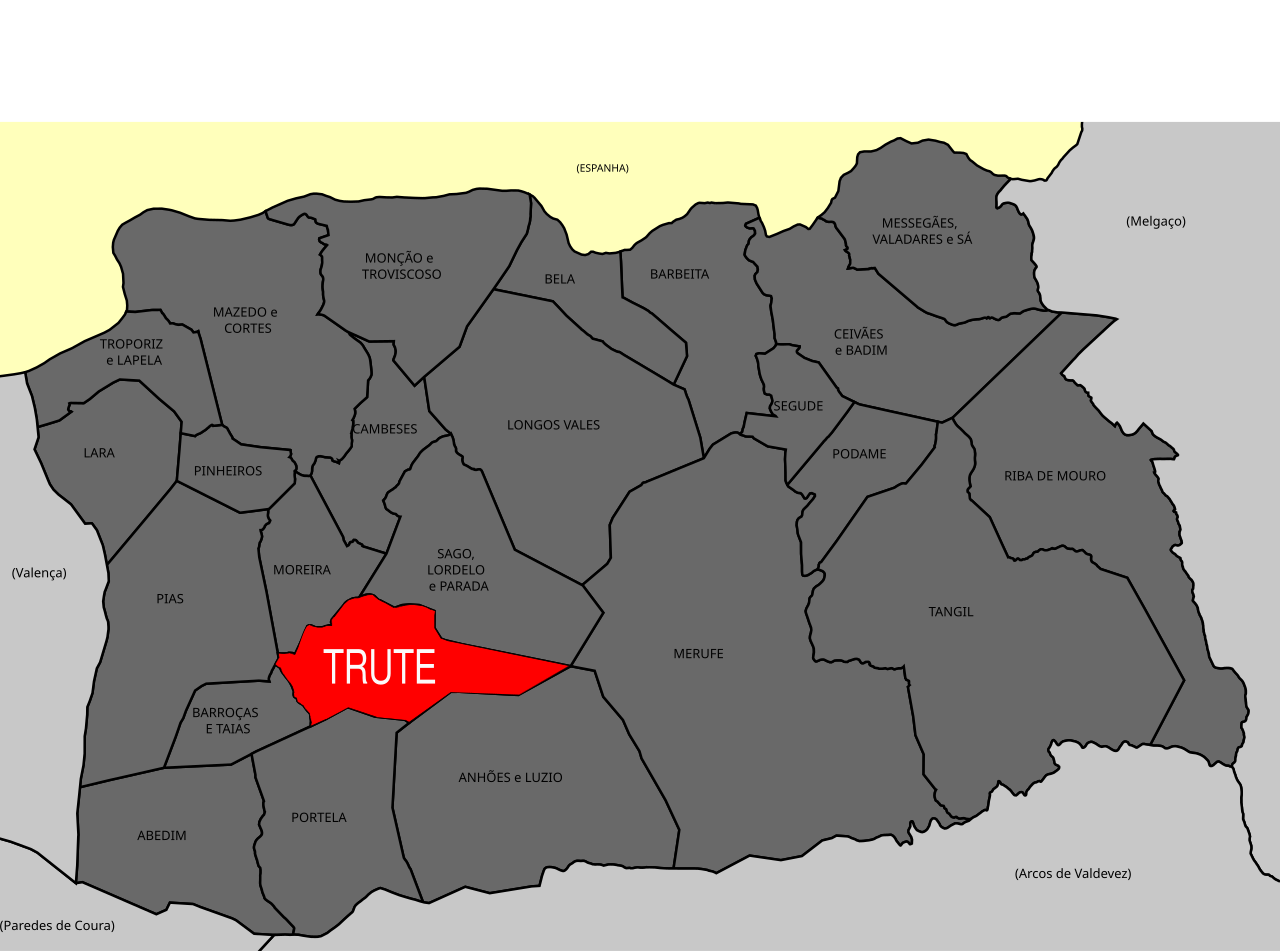
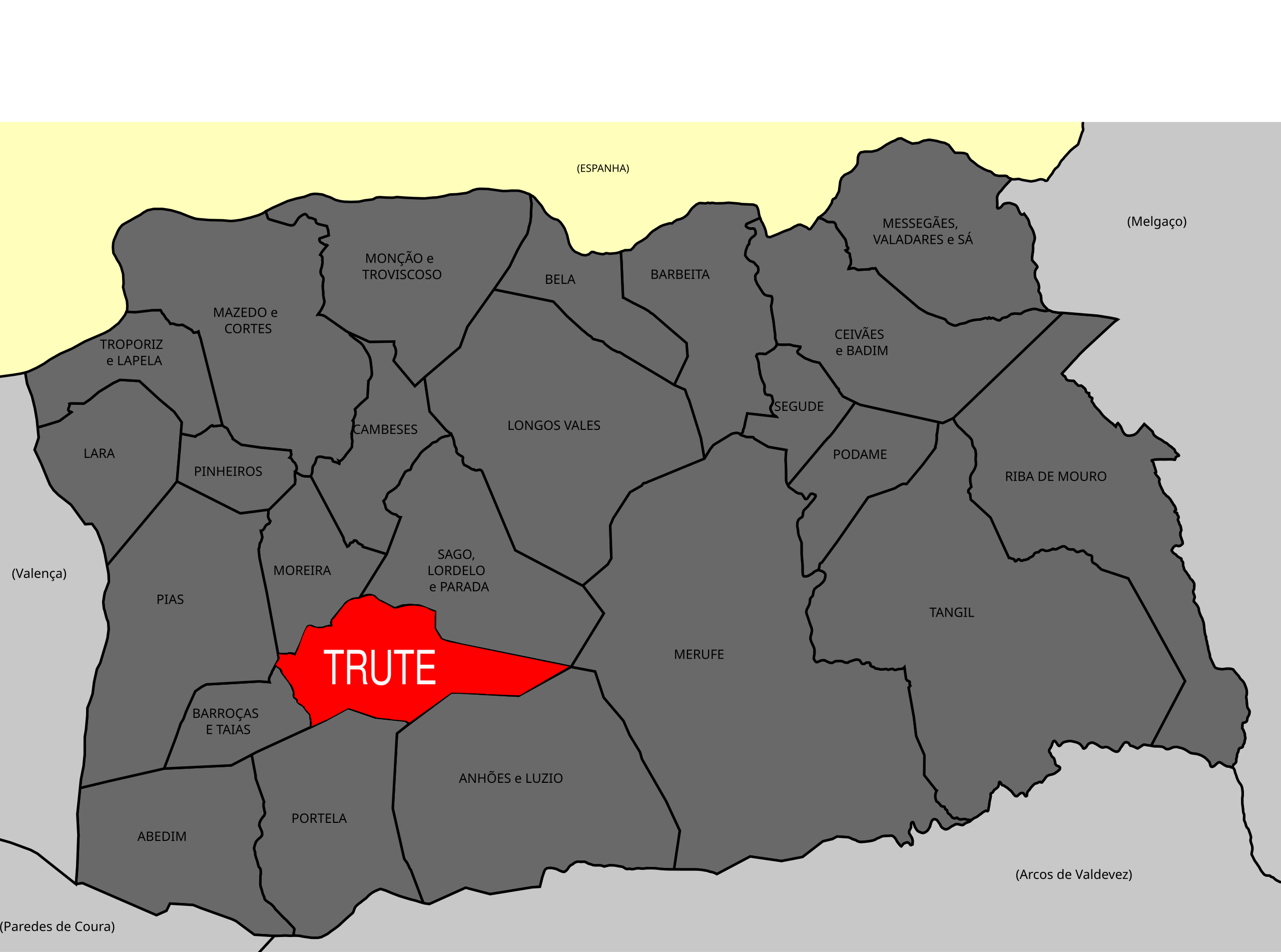
Map of Monção, with Trute highlighted.
Summary
edit
| Description |
Português: Mapa de Moncao com todas as freguesias, com Trute destacado. |
| Date | |
| Source | https://pt.wikipedia.org/wiki/Mon%C3%A7%C3%A3o_(Portugal)#/media/Ficheiro:Mon%C3%A7%C3%A3o_freguesias_2013.svg |
| Author | Gazilion |
#/media/Ficheiro:Mon%C3%A7%C3%A3o_freguesias_2013.svg)
Licensing
edit
| This file is made available under the Creative Commons CC0 1.0 Universal Public Domain Dedication. | |
| The person who associated a work with this deed has dedicated the work to the public domain by waiving all of their rights to the work worldwide under copyright law, including all related and neighboring rights, to the extent allowed by law. You can copy, modify, distribute and perform the work, even for commercial purposes, all without asking permission.
|
File history
Click on a date/time to view the file as it appeared at that time.
| Date/Time | Thumbnail | Dimensions | User | Comment | |
|---|---|---|---|---|---|
| current | 16:24, 14 March 2020 | | 2,470 × 1,835 (233 KB) | Rmffernandes (talk | contribs) | Uploaded a work by Gazilion from https://pt.wikipedia.org/wiki/Mon%C3%A7%C3%A3o_(Portugal)#/media/Ficheiro:Mon%C3%A7%C3%A3o_freguesias_2013.svg with UploadWizard |
You cannot overwrite this file.
File usage on Commons
The following page uses this file:
File usage on other wikis
The following other wikis use this file: