File:Trzcianne (gmina) location map.png
Size of this preview: 570 × 600 pixels. Other resolutions: 228 × 240 pixels | 456 × 480 pixels | 690 × 726 pixels.
Original file (690 × 726 pixels, file size: 114 KB, MIME type: image/png)
Captions
Captions
Add a one-line explanation of what this file represents
| Description |
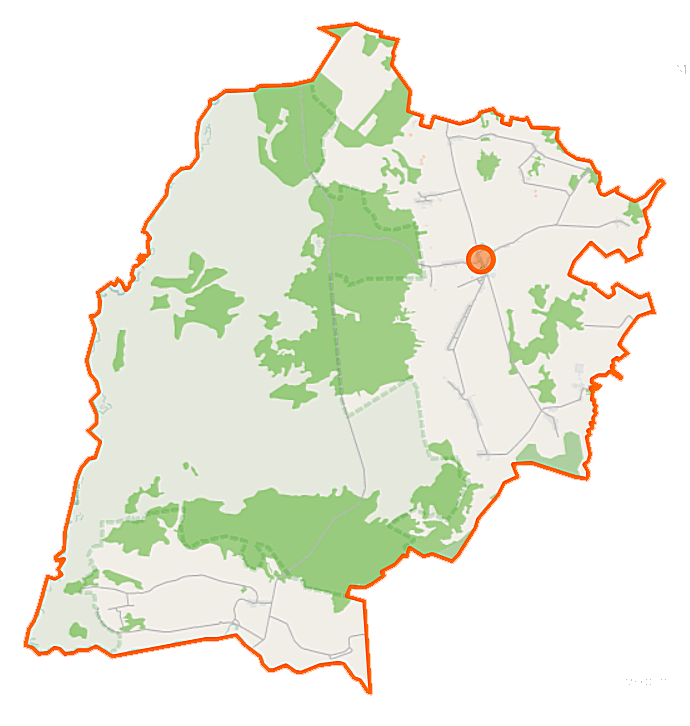
Polski: Mapa gminy Trzcianne, Polska
English: Map of Gmina Trzcianne, Poland |
|||||||||
| Date | ||||||||||
| Source | You may find a page on the OpenStreetMap wiki page for Trzcianne (gmina) | |||||||||
| Creator |
OpenStreetMap contributors OpenStreetMap contributors |
|||||||||
| Permission (Reusing this file) |
OpenStreetMap data is available under the Open Database License (details). Map tiles are licensed under the Creative Commons Attribution-ShareAlike 2.0 license (CC-BY-SA 2.0).
This file is licensed under the Creative Commons Attribution-Share Alike 2.0 Generic license.
|
|||||||||
| Geotemporal data | ||||||||||
| Bounding box |
|
|||||||||
| Georeferencing | If inappropriate please set warp_status = skip to hide. | |||||||||
File history
Click on a date/time to view the file as it appeared at that time.
| Date/Time | Thumbnail | Dimensions | User | Comment | |
|---|---|---|---|---|---|
| current | 09:53, 16 September 2014 | | 690 × 726 (114 KB) | VanWiel (talk | contribs) | |
| 10:44, 16 June 2014 |  | 690 × 726 (150 KB) | VanWiel (talk | contribs) | {{OpenStreetMap | name = Trzcianne (gmina) | location = Trzcianne (gmina) | description = {{pl|Mapa gminy Trzcianne, Polska}} {{en|Map of Gmina Trzcianne, Poland}} | top = 53.4292 | left = 22.4162... |
You cannot overwrite this file.
File usage on Commons
There are no pages that use this file.
File usage on other wikis
The following other wikis use this file:
- Usage on id.wikipedia.org
- Usage on pl.wikipedia.org
- Trzcianne (gmina)
- Trzcianne
- Gugny
- Niewiarowo (Polska)
- Pisanki
- Szorce
- Stare Bajki
- Wilamówka
- Zajki
- Zubole
- Zucielec
- Brzeziny (województwo podlaskie)
- Laskowiec (powiat moniecki)
- Wyszowate (województwo podlaskie)
- Boguszki (powiat moniecki)
- Budy (powiat moniecki)
- Chojnowo (powiat moniecki)
- Giełczyn (powiat moniecki)
- Krynica (powiat moniecki)
- Milewo (powiat moniecki)
- Mroczki (powiat moniecki)
- Boguszewo (gmina Trzcianne)
- Nowa Wieś (powiat moniecki)
- Dobarz
- Kleszcze (województwo podlaskie)
- Korczak (województwo podlaskie)
- Stójka (województwo podlaskie)
- Parafia św. Apostołów Piotra i Pawła w Trzciannem
- Parafia Najświętszego Serca Pana Jezusa w Laskowcu
- Parafia Nawiedzenia Najświętszej Maryi Panny w Giełczynie
- Barwik (Budy)
- Gać (Giełczyn)
- Cmentarz żydowski w Trzciannem
- Kołodzieje (Giełczyn)
- Okrągłe (Niewiarowo)
- Kościół świętych Apostołów Piotra i Pawła w Trzciannem
- Moduł:Mapa/dane/Trzcianne (gmina)
- Usage on pl.wikibooks.org
_location_map.png&oldid=506000328)