File:Tuanjie Lake 2007 b.png
Size of this preview: 800 × 527 pixels. Other resolutions: 320 × 211 pixels | 640 × 421 pixels | 1,024 × 674 pixels | 1,280 × 843 pixels | 3,029 × 1,994 pixels.
Original file (3,029 × 1,994 pixels, file size: 11.51 MB, MIME type: image/png)
Captions
Captions
Tuanjie Lake
Summary
edit
| Description |
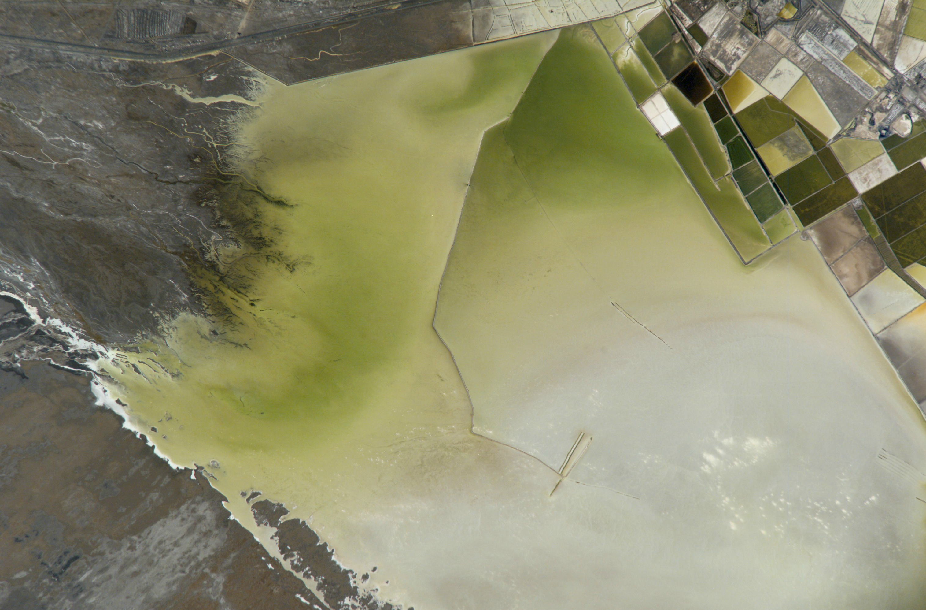
English: ISS016-E-9369: A photograph from the International Space Station of the salt pans collecting minerals from the waters of Tuanjie Lake, Golmud County, Haixi Prefecture, Qinghai Province, China.
Misidentified by NASA as North Hulsan Lake. 中文:中国青海省海西格尔木市。团结湖。 |
| Date | 07:29:59 GMT on 3 November 2007 |
| Source | ISS016 photographs at Gateway to Astronaut Photography of Earth |
| Author | NASA |
Licensing
edit
| This file is in the public domain in the United States because it was solely created by NASA. NASA copyright policy states that "NASA material is not protected by copyright unless noted". (See Template:PD-USGov, NASA copyright policy page or JPL Image Use Policy.) | ||
 |
Warnings:
|
File history
Click on a date/time to view the file as it appeared at that time.
| Date/Time | Thumbnail | Dimensions | User | Comment | |
|---|---|---|---|---|---|
| current | 17:53, 9 August 2019 | | 3,029 × 1,994 (11.51 MB) | LlywelynII (talk | contribs) | User created page with UploadWizard |
You cannot overwrite this file.
File usage on Commons
The following page uses this file:
File usage on other wikis
The following other wikis use this file:
- Usage on en.wikipedia.org
- Usage on pa.wikipedia.org
- Usage on pnb.wikipedia.org