File:Tunnunik - Landsat OLI 52.png
Size of this preview: 800 × 438 pixels. Other resolutions: 320 × 175 pixels | 640 × 350 pixels | 1,024 × 560 pixels | 1,280 × 701 pixels | 2,560 × 1,401 pixels | 6,600 × 3,612 pixels.
Original file (6,600 × 3,612 pixels, file size: 7.8 MB, MIME type: image/png)
Captions
Captions
Add a one-line explanation of what this file represents
Summary edit
| Description |
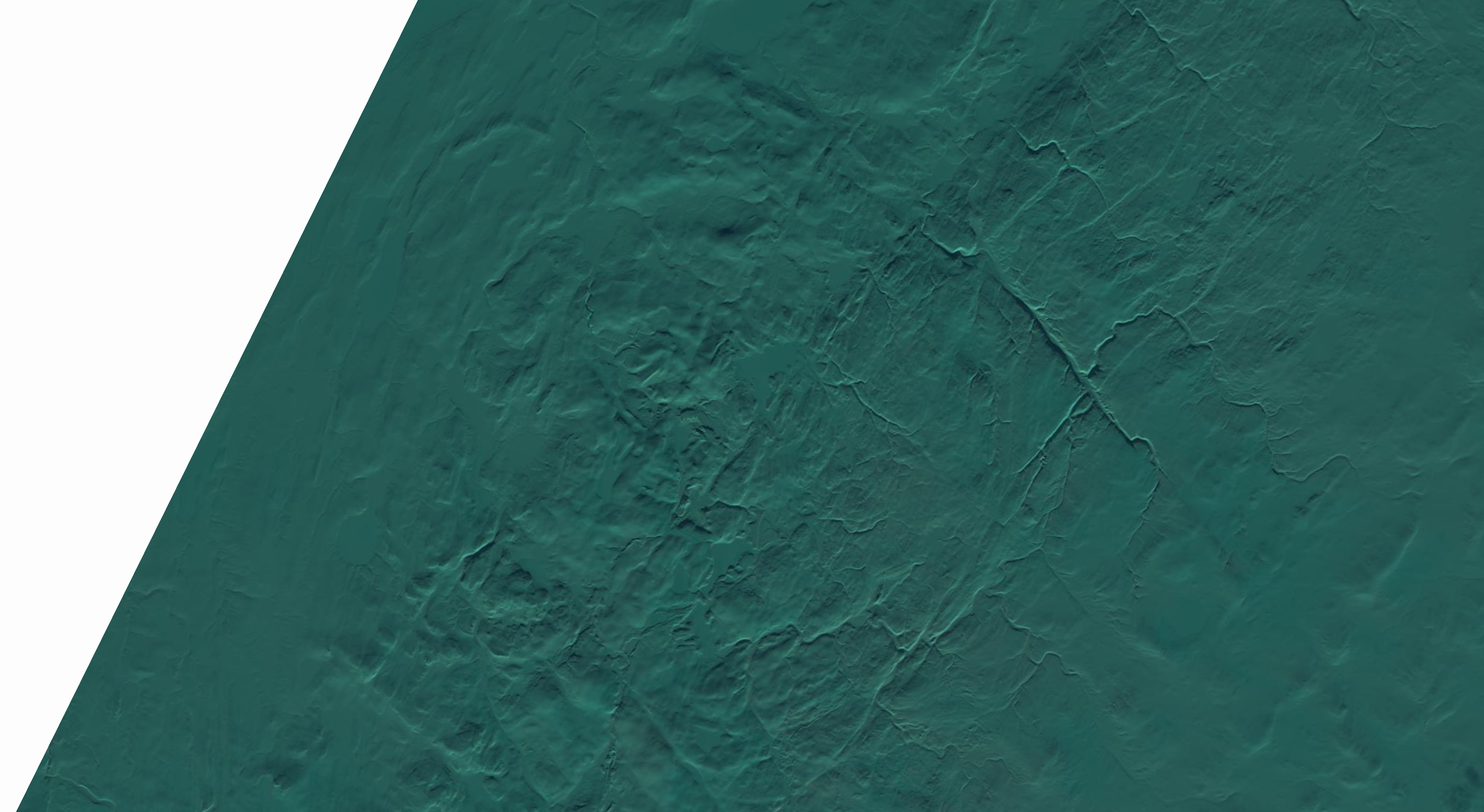
Polski: Krater uderzeniowy Tunnunik na Wyspie Wiktorii w Kanadzie; jego topografię uwydatniają padające pod niskim kątem promienie Słońca.
English: Tunnunik impact crater on Victoria Island, Canada; the topography is highlighted by low sunlight. |
| Date | |
| Source | USGS LandsatLook Viewer |
| Author | USGS/NASA |
| Camera location | | View this and other nearby images on: OpenStreetMap |
|---|
Licensing edit
This image is in the public domain in the United States because it only contains materials that originally came from the United States Geological Survey, an agency of the United States Department of the Interior. For more information, see the official USGS copyright policy.
|
File history
Click on a date/time to view the file as it appeared at that time.
| Date/Time | Thumbnail | Dimensions | User | Comment | |
|---|---|---|---|---|---|
| current | 18:55, 10 June 2016 | | 6,600 × 3,612 (7.8 MB) | Szczureq (talk | contribs) | User created page with UploadWizard |
You cannot overwrite this file.
File usage on Commons
The following page uses this file:
File usage on other wikis
The following other wikis use this file:
- Usage on pl.wikipedia.org