File:Turkey aladag.PNG

Size of this preview: 800 × 389 pixels. Other resolutions: 320 × 156 pixels | 640 × 311 pixels | 1,332 × 648 pixels.
Original file (1,332 × 648 pixels, file size: 1.81 MB, MIME type: image/png)
Captions
Captions
Add a one-line explanation of what this file represents
Summary edit
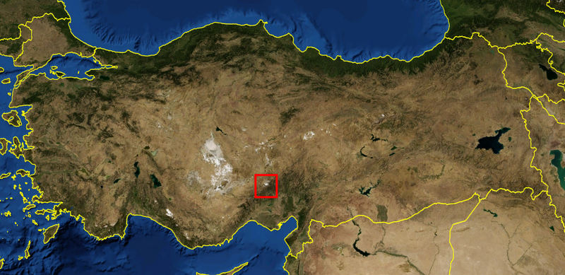
| Description | physical map of Turkey, with Aladağ range showed |
| Date | |
| Source | self-made, from NASA World Wind (Public domain) |
| Author | Bicounet |
Licensing edit
| I, the copyright holder of this work, release this work into the public domain. This applies worldwide. In some countries this may not be legally possible; if so: I grant anyone the right to use this work for any purpose, without any conditions, unless such conditions are required by law. |
File history
Click on a date/time to view the file as it appeared at that time.
| Date/Time | Thumbnail | Dimensions | User | Comment | |
|---|---|---|---|---|---|
| current | 14:36, 25 September 2007 | | 1,332 × 648 (1.81 MB) | Bicounet~commonswiki (talk | contribs) | {{Information |Description= physical map of Turkey, with Aladağ range showed |Source=self-made, from NASA World Wind (Public domain) |Date= 25 September 2007 |Author= Bicounet }} |
You cannot overwrite this file.
File usage on Commons
There are no pages that use this file.
File usage on other wikis
The following other wikis use this file:
- Usage on fa.wikipedia.org
- Usage on it.wikipedia.org
- Usage on pt.wikipedia.org