File:Turnback-Memminger-filmt.jpg
Size of this preview: 800 × 533 pixels. Other resolutions: 320 × 213 pixels | 640 × 427 pixels | 1,024 × 683 pixels | 1,476 × 984 pixels.
Original file (1,476 × 984 pixels, file size: 608 KB, MIME type: image/jpeg)
File information
Structured data
Captions
Summary
editDescriptionTurnback-Memminger-filmt.jpg |
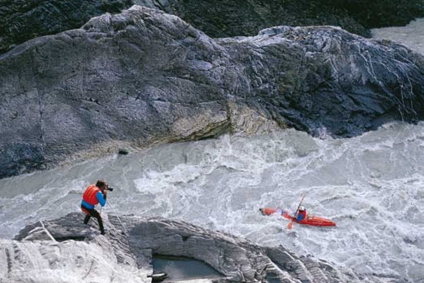
Deutsch: Hans Memminger filmt Mike Hierl im Turnback Canyon, Alsek River. |
Date | |
Source | Own work |
Author | Archiv Memminger |
Camera location | 59° 48′ 36″ N, 137° 56′ 09.6″ W | View this and other nearby images on: OpenStreetMap | 59.810000; -137.936000 |
---|
Licensing
editI, the copyright holder of this work, hereby publish it under the following license:
This file is licensed under the Creative Commons Attribution-Share Alike 4.0 International license.
- You are free:
- to share – to copy, distribute and transmit the work
- to remix – to adapt the work
- Under the following conditions:
- attribution – You must give appropriate credit, provide a link to the license, and indicate if changes were made. You may do so in any reasonable manner, but not in any way that suggests the licensor endorses you or your use.
- share alike – If you remix, transform, or build upon the material, you must distribute your contributions under the same or compatible license as the original.
File history
Click on a date/time to view the file as it appeared at that time.
Date/Time | Thumbnail | Dimensions | User | Comment | |
---|---|---|---|---|---|
current | 01:36, 25 February 2016 | 1,476 × 984 (608 KB) | Archiv Memminger (talk | contribs) | User created page with UploadWizard |
You cannot overwrite this file.
File usage on Commons
The following 3 pages use this file:
File usage on other wikis
The following other wikis use this file:
- Usage on de.wikipedia.org
Metadata
This file contains additional information such as Exif metadata which may have been added by the digital camera, scanner, or software program used to create or digitize it. If the file has been modified from its original state, some details such as the timestamp may not fully reflect those of the original file. The timestamp is only as accurate as the clock in the camera, and it may be completely wrong.
Image title |
|
---|---|
Author | Claus Streckmann |
Date and time of data generation | 00:00, 1 July 1981 |
Latitude | 59° 48′ 36″ N |
Longitude | 137° 56′ 9.6″ W |
Altitude | 300 meters above sea level |
Person depicted |
|
Copyright holder |
|
Short title |
|
Credit/Provider | Hans Memminger,Mike Hierl |
Headline | Kajak im strudelnden Wasser der Schlucht. |
Online copyright statement | http://sites.google.com/site/alsekriv |
City shown | Tatshenshini-Alsek Provincial Park |
City that the picture was taken in | Tatshenshini-Alsek Provincial Park |
Horizontal resolution | 72 dpi |
Vertical resolution | 72 dpi |
File change date and time | 00:00, 1 July 1981 |
Y and C positioning | Centered |
Exif version | 2.3 |
Date and time of digitizing | 00:00, 1 July 1981 |
Meaning of each component |
|
Supported Flashpix version | 1 |
Color space | Uncalibrated |
Reference for direction of image | True direction |
Direction of image | 250 |
GPS tag version | 2.3.0.0 |
Contact information | river.alsek@gmail.com
http://sites.google.com/site/alsekriv
|
Type of item | Natur,Expedition |
Date(s) | 00:00, 1 July 1981 |
Source media | Archiv Memminger |
Keywords |
|
Rating (out of 5) | 3 |
Copyright status | Copyrighted |
Code for country shown | CAN |
Country shown | Kanada |
Province or state shown | British Columbia |
Sublocation of city shown | St. Elias Mountains |
World region shown | Amerika |
Code for the country that the picture was taken in | CAN |
Country that the picture was taken in | Kanada |
Province or state that the picture was taken in | British Columbia |
Sublocation of the city that the picture was taken in | St. Elias Mountains |
World region that the picture was taken in | Amerika |