File:Tuscarora.png
Size of this preview: 784 × 600 pixels. Other resolutions: 314 × 240 pixels | 627 × 480 pixels | 1,004 × 768 pixels | 1,248 × 955 pixels.
Original file (1,248 × 955 pixels, file size: 75 KB, MIME type: image/png)
Captions
Captions
Add a one-line explanation of what this file represents
Summary edit

|
This file was moved to Wikimedia Commons from en.wikipedia using a bot script. All source information is still present. It requires review. Additionally, there may be errors in any or all of the information fields; information on this file should not be considered reliable and the file should not be used until it has been reviewed and any needed corrections have been made. Once the review has been completed, this template should be removed. For details about this file, see below. Check now! |
| Description |
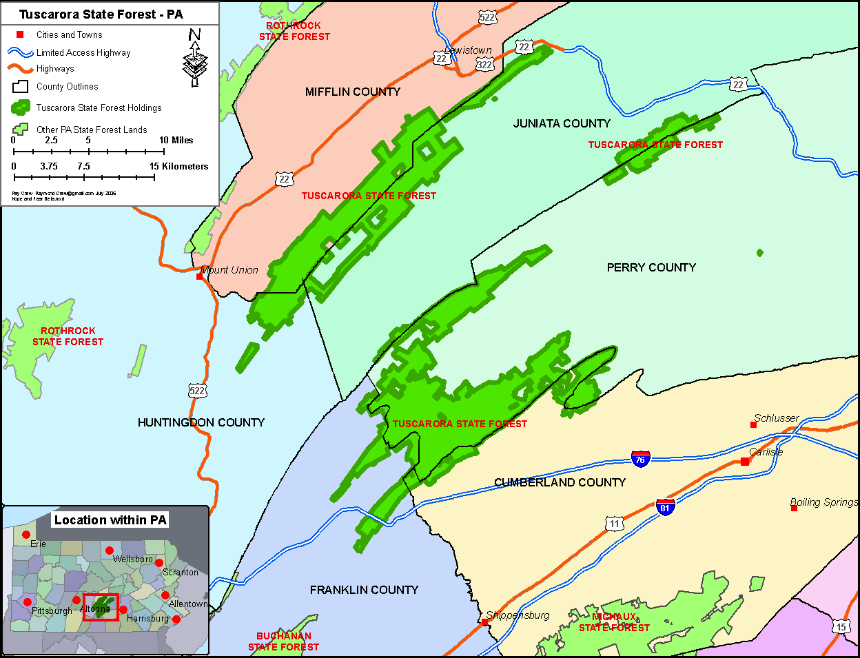
English: Map created using ArcMap 9.1 with Service Pack 1 by Raymond Crew. Data layers from ESRI Data 2004, PA DCNR data and USGS data. Exported as a 150 dpi PNG file from ArcMap. |
| Date | 1 February 2006 (original upload date) |
| Source | Transferred from en.wikipedia to Commons by Premeditated Chaos using CommonsHelper. |
| Author | Rcc105 at English Wikipedia |
Licensing edit
| This work has been released into the public domain by its author, Rcc105 at English Wikipedia. This applies worldwide. In some countries this may not be legally possible; if so: Rcc105 grants anyone the right to use this work for any purpose, without any conditions, unless such conditions are required by law. |
Original upload log edit
The original description page was here. All following user names refer to en.wikipedia.
- 2006-07-15 11:08 Rcc105 1248×955× (77069 bytes) New version with updated border info and locational info.
- 2006-02-01 11:48 Rcc105 1650×1275× (70356 bytes) New version with 10x scale bars. (Second try at this)
- 2006-02-01 11:47 Rcc105 1650×1275× (70356 bytes) New version with 10 mile and 10 km scale bars. Map created using ArcMap 9.1 with Service Pack 1 by Raymond Crew. Data layers from ESRI Data 2004, PA DCNR data and USGS data. Exported as a 150 dpi PNG file from ArcMap.
- 2006-02-01 11:45 Rcc105 1650×1275× (70476 bytes) Map created using ArcMap 9.1 with Service Pack 1 by Raymond Crew. Data layers from ESRI Data 2004, PA DCNR data and USGS data. Exported as a 150 dpi PNG file from ArcMap.
File history
Click on a date/time to view the file as it appeared at that time.
| Date/Time | Thumbnail | Dimensions | User | Comment | |
|---|---|---|---|---|---|
| current | 00:39, 23 February 2012 | | 1,248 × 955 (75 KB) | File Upload Bot (Magnus Manske) (talk | contribs) | {{BotMoveToCommons|en.wikipedia|year={{subst:CURRENTYEAR}}|month={{subst:CURRENTMONTHNAME}}|day={{subst:CURRENTDAY}}}} {{Information |Description={{en|Map created using ArcMap 9.1 with Service Pack 1 by Raymond Crew. Data layers from ESRI Data 2004, P... |
You cannot overwrite this file.
File usage on Commons
There are no pages that use this file.