File:Txu-oclc-6614368-nl52-9.jpg

Size of this preview: 785 × 599 pixels. Other resolutions: 314 × 240 pixels | 629 × 480 pixels | 1,006 × 768 pixels | 1,280 × 977 pixels | 2,560 × 1,955 pixels | 5,000 × 3,818 pixels.
Original file (5,000 × 3,818 pixels, file size: 5.26 MB, MIME type: image/jpeg)
Captions
Captions
Add a one-line explanation of what this file represents
Summary edit
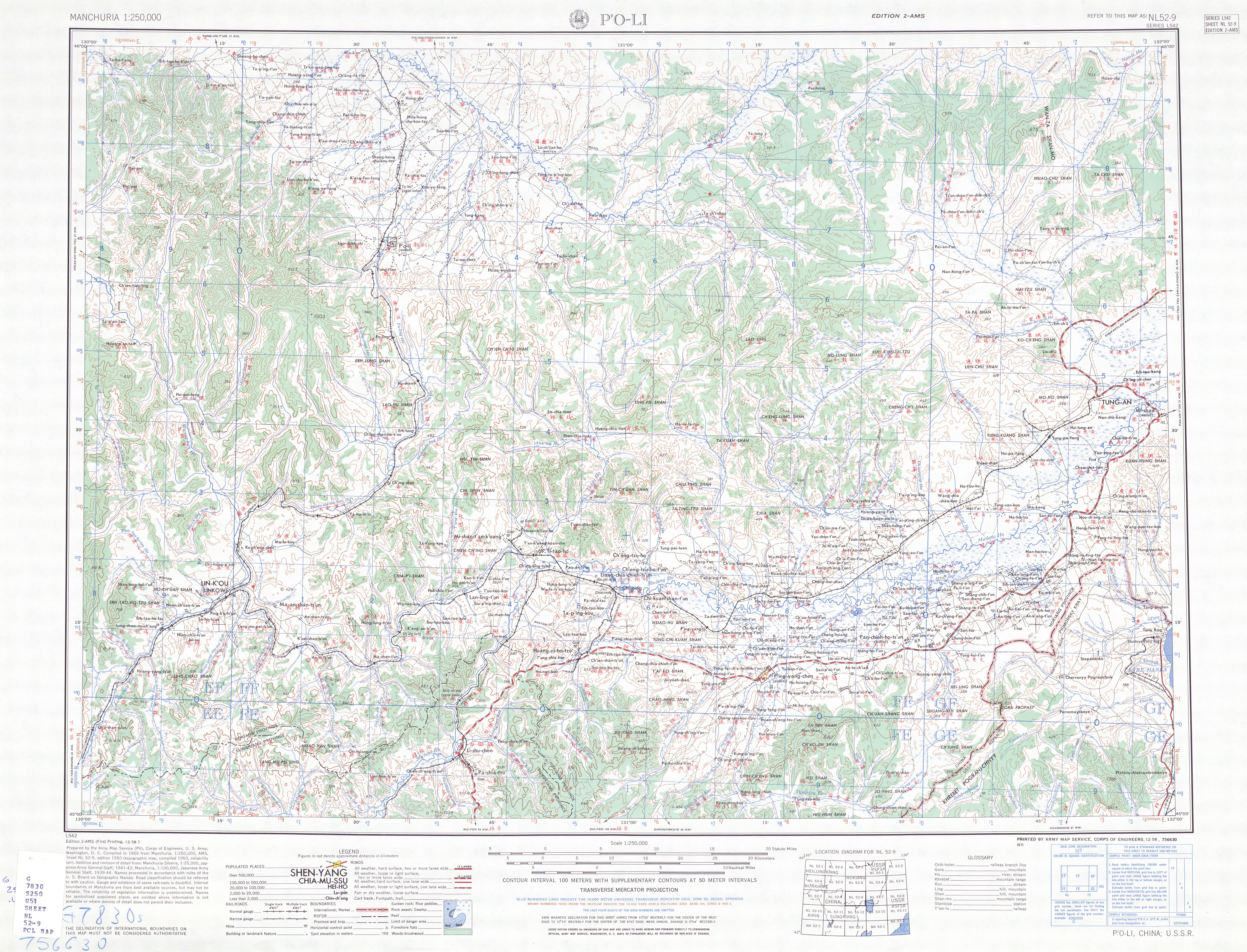
| Description | |
| Date | |
| Source | http://legacy.lib.utexas.edu/maps/ams/manchuria/txu-oclc-6614368-nl52-9.jpg |
| Author | Army Map Serivce (PV), Corps of Engineers 1955 |
-
 Index Map

Licensing edit
This image or file is a work of a U.S. Army Corps of Engineers soldier or employee, taken or made as part of that person's official duties. As a work of the U.S. federal government, the image is in the public domain.
|
File history
Click on a date/time to view the file as it appeared at that time.
| Date/Time | Thumbnail | Dimensions | User | Comment | |
|---|---|---|---|---|---|
| current | 09:14, 11 September 2019 | | 5,000 × 3,818 (5.26 MB) | Geographyinitiative (talk | contribs) | User created page with UploadWizard |
You cannot overwrite this file.
File usage on Commons
There are no pages that use this file.
File usage on other wikis
The following other wikis use this file:
- Usage on en.wikipedia.org