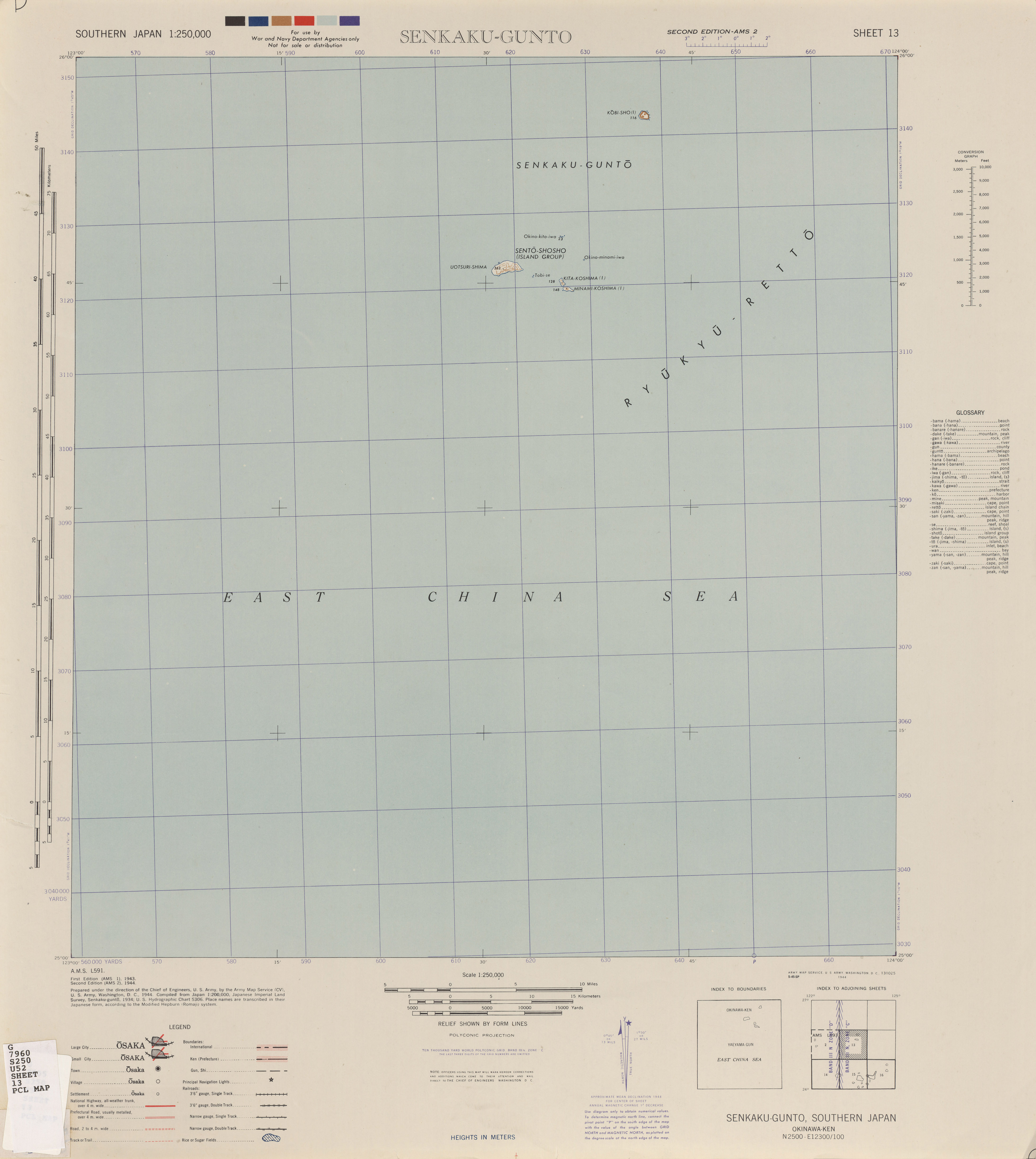
File:Txu-pclmaps-oclc-6618306-senkaku-gunto-13.jpg
Size of this preview: 536 × 600 pixels. Other resolutions: 214 × 240 pixels | 429 × 480 pixels | 686 × 768 pixels | 915 × 1,024 pixels | 1,830 × 2,048 pixels | 3,911 × 4,376 pixels.
Original file (3,911 × 4,376 pixels, file size: 1.81 MB, MIME type: image/jpeg)
Captions
Captions
Add a one-line explanation of what this file represents
Summary edit
| Description |
中文(繁體):Series L591 |
| Date | |
| Source | http://legacy.lib.utexas.edu/maps/ams/southern_japan/ |
| Author | AMS |
Licensing edit
This image or file is a work of a U.S. Army Corps of Engineers soldier or employee, taken or made as part of that person's official duties. As a work of the U.S. federal government, the image is in the public domain.
|
File history
Click on a date/time to view the file as it appeared at that time.
| Date/Time | Thumbnail | Dimensions | User | Comment | |
|---|---|---|---|---|---|
| current | 08:29, 20 October 2019 | | 3,911 × 4,376 (1.81 MB) | Geographyinitiative (talk | contribs) | User created page with UploadWizard |
You cannot overwrite this file.
File usage on Commons
There are no pages that use this file.
File usage on other wikis
The following other wikis use this file:
- Usage on en.wikipedia.org
- Usage on ka.wikipedia.org