File:Tyllwyn Halt railway station (site), Blaenau Gwent (geograph 4615025).jpg
Size of this preview: 800 × 600 pixels. Other resolutions: 320 × 240 pixels | 640 × 480 pixels | 1,024 × 768 pixels | 1,280 × 960 pixels | 1,600 × 1,200 pixels.
Original file (1,600 × 1,200 pixels, file size: 361 KB, MIME type: image/jpeg)
Captions
Captions
Add a one-line explanation of what this file represents
Summary
edit,_Blaenau_Gwent_(geograph_4615025).jpg&action=edit§ion=1)
| Description |
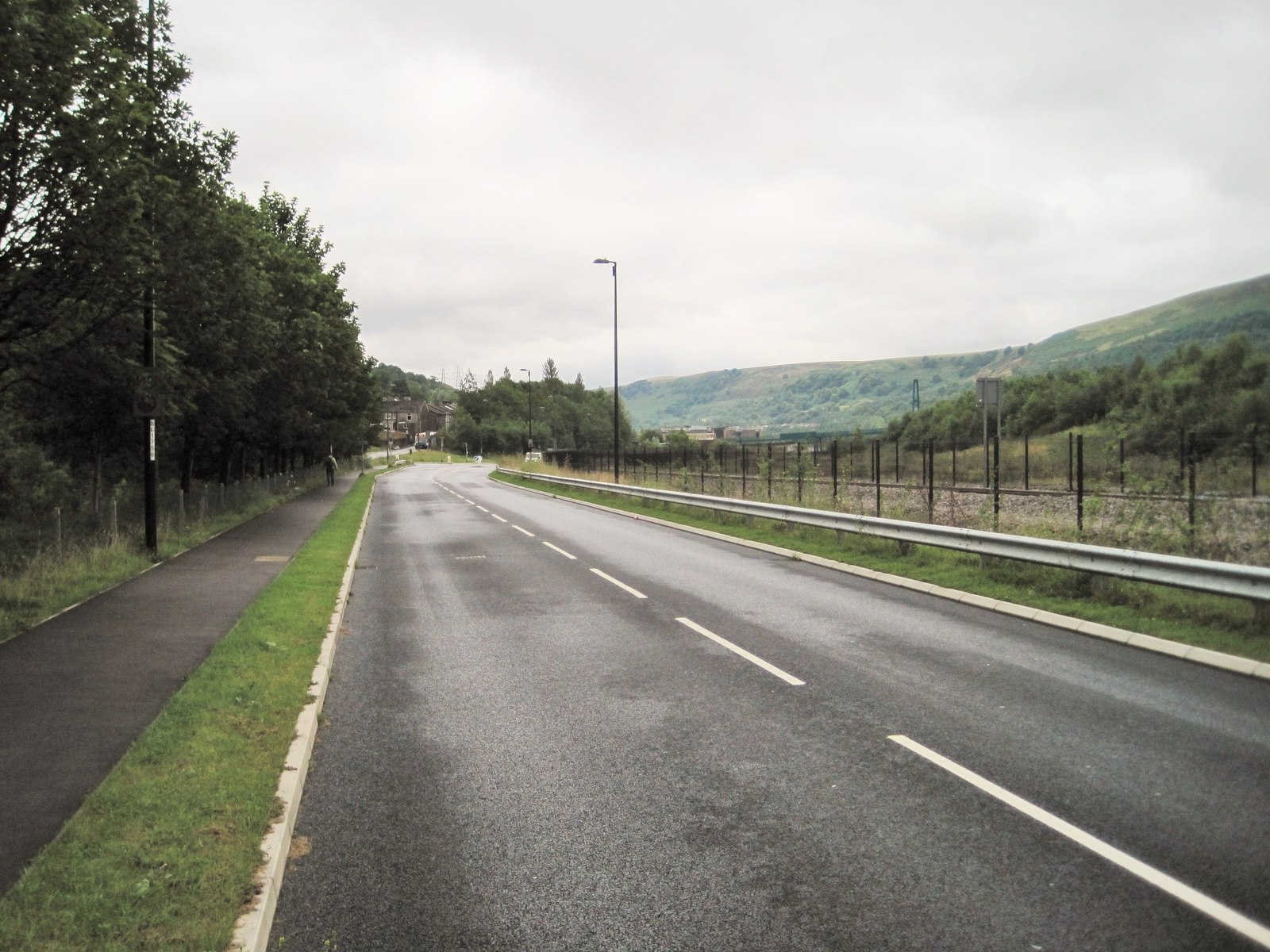
English: Tyllwyn Halt railway station (site), Blaenau Gwent Opened on an unknown date on the Great Western Railway's line from Newport (Gwent) to Ebbw Vale Low Level, this station closed in 1962. View south towards Ebbw Vale Parkway and Newport, Cardiff etc. The current line runs to the right of the fence. The exact location is hard to pinpoint due to complete redevelopment of the area but is believed to have been roughly between the lamp post in the centre of the image and the bend in the road. |
| Date | |
| Source | From geograph.org.uk |
| Author | Nigel Thompson |
| Permission (Reusing this file) |
Creative Commons Attribution Share-alike license 2.0 |
| Attribution (required by the license) | Nigel Thompson / Tyllwyn Halt railway station (site), Blaenau Gwent / |
| Camera location | | View this and other nearby images on: OpenStreetMap |
|---|
,_Blaenau_Gwent_(geograph_4615025).jpg¶ms=051.772911_N_-003.199839_E_globe:Earth_type:camera_source:geograph-osgb36(SO17310893)_heading:157.00&language=en)
| Object location | | View this and other nearby images on: OpenStreetMap |
|---|
,_Blaenau_Gwent_(geograph_4615025).jpg¶ms=051.772020_N_-003.199380_E_globe:Earth_class:object_type:object_source:geograph-osgb36(SO17340883)_heading:157.00&language=en)
Licensing
edit,_Blaenau_Gwent_(geograph_4615025).jpg&action=edit§ion=2)

|
This image was taken from the Geograph project collection. See this photograph's page on the Geograph website for the photographer's contact details. The copyright on this image is owned by Nigel Thompson and is licensed for reuse under the Creative Commons Attribution-ShareAlike 2.0 license.
|
This file is licensed under the Creative Commons Attribution-Share Alike 2.0 Generic license.
Attribution: Nigel Thompson
- You are free:
- to share – to copy, distribute and transmit the work
- to remix – to adapt the work
- Under the following conditions:
- attribution – You must give appropriate credit, provide a link to the license, and indicate if changes were made. You may do so in any reasonable manner, but not in any way that suggests the licensor endorses you or your use.
- share alike – If you remix, transform, or build upon the material, you must distribute your contributions under the same or compatible license as the original.
File history
Click on a date/time to view the file as it appeared at that time.
| Date/Time | Thumbnail | Dimensions | User | Comment | |
|---|---|---|---|---|---|
| current | 18:37, 1 January 2020 | | 1,600 × 1,200 (361 KB) | Lamberhurst (talk | contribs) | Transferred from geograph.co.uk using [https://tools.wmflabs.org/geograph2commons/ geograph2commons] |
You cannot overwrite this file.
File usage on Commons
The following page uses this file:
,_Blaenau_Gwent_(geograph_4615025).jpg&oldid=657921473)