File:Typh longwang sept28.jpg

Size of this preview: 600 × 600 pixels. Other resolutions: 240 × 240 pixels | 480 × 480 pixels | 768 × 768 pixels | 1,024 × 1,024 pixels | 2,048 × 2,048 pixels | 7,800 × 7,800 pixels.
Original file (7,800 × 7,800 pixels, file size: 9.49 MB, MIME type: image/jpeg)
Captions
Captions
Add a one-line explanation of what this file represents
| Warning | The original file is very high-resolution. It might not load properly or could cause your browser to freeze when opened at full size. |
|---|
Summary edit
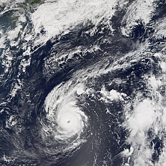
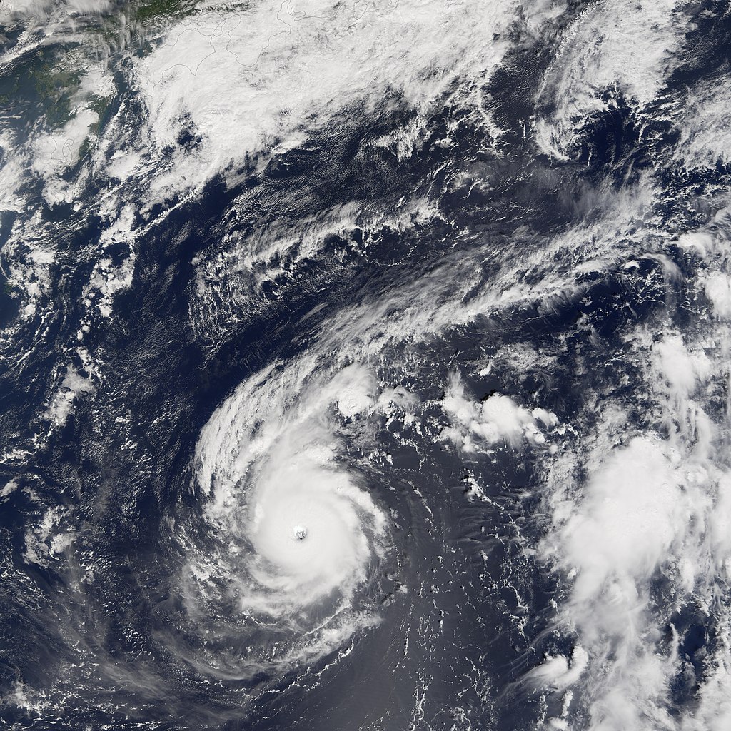
| Description | Typhoon Longwang was a small but well-organized and powerful storm system when the Moderate Resolution Imaging Spectroradiometer (MODIS) on NASA’s Terra satellite captured this image at 10:30 a.m. local time, on September 28, 2005. At the time of this MODIS observation, Longwang was 900 kilometers (590 miles) from Okinawa and a comparable distance south of Honshu (the main island in the Japanese chain at the top of this image). It was travelling roughly westward towards the Chinese coast on a track that would take it through the southern fringe of the Japanese islands. Typhoon Longwang had sustained winds of 200 kilometers per hour (125 miles per hour) near the storm’s center, and it was projected to continue to strengthen slightly in the following days. | |||||
| Date | ||||||
| Source | http://earthobservatory.nasa.gov/NaturalHazards/natural_hazards_v2.php3?img_id=13169 | |||||
| Author | NASA image created by Jesse Allen, Earth Observatory, using data courtesy of the MODIS Rapid Response team. | |||||
| Permission (Reusing this file) |
|

File history
Click on a date/time to view the file as it appeared at that time.
| Date/Time | Thumbnail | Dimensions | User | Comment | |
|---|---|---|---|---|---|
| current | 23:11, 6 September 2006 | | 7,800 × 7,800 (9.49 MB) | Good kitty (talk | contribs) | == Summary == {{Information |Description=Typhoon Longwang was a small but well-organized and powerful storm system when the Moderate Resolution Imaging Spectroradiometer (MODIS) on NASA’s Terra satellite captured this image at 10:30 a.m. local time, on |
You cannot overwrite this file.
File usage on Commons
There are no pages that use this file.
File usage on other wikis
The following other wikis use this file:
- Usage on fr.wikipedia.org
- Usage on zh-min-nan.wikipedia.org