File:Typhoon Connie analysis 6 Jun 1945.png
No higher resolution available.
Typhoon_Connie_analysis_6_Jun_1945.png (500 × 532 pixels, file size: 490 KB, MIME type: image/png)
Captions
Captions
Add a one-line explanation of what this file represents
Summary
edit
| Description |
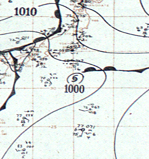
English: Surface weather analysis map of Typhoon Connie on June 6, 1945. |
| Date | |
| Source | http://docs.lib.noaa.gov/rescue/swm/1945/19450606.pdf |
| Author | NOAA Central Library, Silver Springs, MD |
Licensing
edit
This image is in the public domain because it contains materials that originally came from the U.S. National Oceanic and Atmospheric Administration, taken or made as part of an employee's official duties.
|
File history
Click on a date/time to view the file as it appeared at that time.
| Date/Time | Thumbnail | Dimensions | User | Comment | |
|---|---|---|---|---|---|
| current | 01:02, 2 September 2013 | | 500 × 532 (490 KB) | Supportstorm (talk | contribs) | {{Information |Description ={{en|1=Surface weather analysis map of Typhoon Connie on June 6, 1945.}} |Source =http://docs.lib.noaa.gov/rescue/swm/1945/19450606.pdf |Author =NOAA Central Library, Silver Springs, MD |Date =19... |
You cannot overwrite this file.
File usage on Commons
There are no pages that use this file.