File:U234 map de.png

Size of this preview: 800 × 550 pixels. Other resolutions: 320 × 220 pixels | 640 × 440 pixels | 1,024 × 704 pixels.
Original file (1,024 × 704 pixels, file size: 465 KB, MIME type: image/png)
Captions
Captions
Add a one-line explanation of what this file represents
Summary edit
| Description |
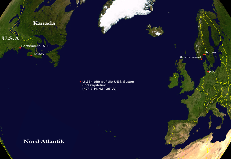
English: The patrol of the Unterseeboot 234 mapped, german labels |
| Date | |
| Source | NASA Worldwind 1.3.1.1 |
| Author | Andreas Wiesenhofer, Fook 19:23, 16 Jun 2005 (UTC) |
| Other versions |
 |
Licensing edit
| This file is in the public domain in the United States because it was solely created by NASA. NASA copyright policy states that "NASA material is not protected by copyright unless noted". (See Template:PD-USGov, NASA copyright policy page or JPL Image Use Policy.) | ||
 |
Warnings:
|
This image uses high-resolution digital topography data from NASA's Shuttle Radar Topography Mission (SRTM) at JPL-Caltech [4]. It is in the public domain in the United States.
|
 | |
File history
Click on a date/time to view the file as it appeared at that time.
| Date/Time | Thumbnail | Dimensions | User | Comment | |
|---|---|---|---|---|---|
| current | 19:23, 16 June 2005 | | 1,024 × 704 (465 KB) | Fook~commonswiki (talk | contribs) | {{Information| |Description = The patrol of the Unterseeboot 234 mapped, german |Source = NASA Worldwind 1.3.1.1 |Date = 16. June, 2005 |Author = Andreas Wiesenhofer, ~~~~ |Permission = |other_versions = Map without Labels }} |
You cannot overwrite this file.
File usage on Commons
The following page uses this file:
File usage on other wikis
The following other wikis use this file:
- Usage on de.wikipedia.org