File:UN-Karte Kroatiens.svg

Original file (SVG file, nominally 900 × 662 pixels, file size: 493 KB)
Captions
Captions
Summary edit
| Description |
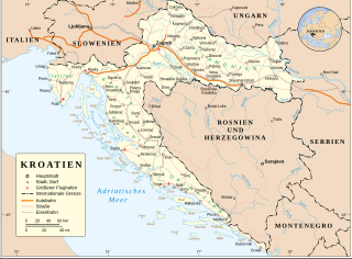
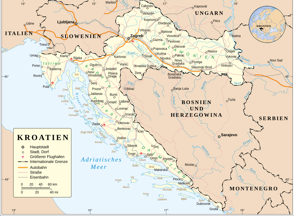
Deutsch: Karte Kroatiens.
English: Map of Croatia |
|||
| Date | ||||
| Source | Derived from UN Map of Croatia (pdf) | |||
| Author | United Nations Cartographic Section, modified by Furfur | |||
| Permission (Reusing this file) |
|
|||
| SVG development | This map was created with Adobe Illustrator. |

File history
Click on a date/time to view the file as it appeared at that time.
| Date/Time | Thumbnail | Dimensions | User | Comment | |
|---|---|---|---|---|---|
| current | 23:09, 29 May 2021 | | 900 × 662 (493 KB) | Furfur (talk | contribs) | gesperrte Schrift |
| 23:05, 29 May 2021 |  | 900 × 662 (493 KB) | Furfur (talk | contribs) | stärkere Farben | |
| 22:48, 29 May 2021 |  | 900 × 662 (493 KB) | Furfur (talk | contribs) | == {{int:filedesc}} == {{Information |Description={{de|1=Karte Kroatiens.}} {{en|1=Map of Croatia}} |Source=Derived from [https://www.un.org/Depts/Cartographic/map/profile/croatia.pdf UN Map of Croatia (pdf)] |Author=United Nations Cartographic Section, modified by {{U|Furfur}} |Date=2021-05-30 |Permission={{UN map}} |other versions= |other_fields={{Igen|A|+|%|s=m}} }} Category:Political maps of Croatia Category:SVG maps in German Category:SVG maps of Croatia |
You cannot overwrite this file.
File usage on Commons
The following 2 pages use this file: