File:UNIKOM map 2001.png

Original file (3,096 × 2,056 pixels, file size: 1.14 MB, MIME type: image/png)
Captions
Captions
| Description |
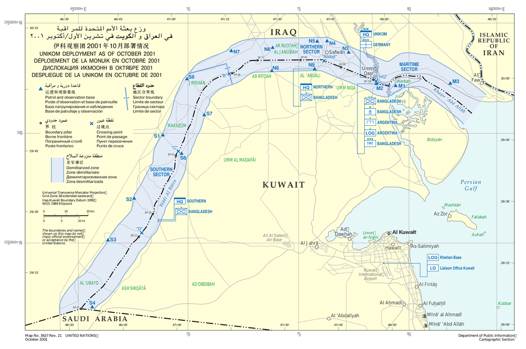
English: United Nations Iraq–Kuwait Observation Mission map deployment as of October 2001.
Español: Mapa del despliegue de la Misión de Observación de las Naciones Unidas para Irak y Kuwait a octubre de 2001. |
|||
| Date | ||||
| Source | United Nations Cartographic Section | |||
| Author | United Nations | |||
| Permission (Reusing this file) |
|

File history
Click on a date/time to view the file as it appeared at that time.
| Date/Time | Thumbnail | Dimensions | User | Comment | |
|---|---|---|---|---|---|
| current | 00:08, 24 October 2011 | | 3,096 × 2,056 (1.14 MB) | Montgomery (talk | contribs) | {{Information |Description ={{en|1=United Nations Iraq–Kuwait Observation Mission map deployment as of October 2001.}} {{es|1=Mapa del despliegue de la Misión de Observación de las Naciones Unidas para Irak y Kuwait a octubre de 2001.}} |Source |
You cannot overwrite this file.
File usage on Commons
There are no pages that use this file.
File usage on other wikis
The following other wikis use this file:
- Usage on ca.wikipedia.org
- Usage on es.wikipedia.org
- Usage on nl.wikipedia.org
- Usage on no.wikipedia.org
- Usage on pt.wikipedia.org
- Usage on uk.wikipedia.org
- Usage on www.wikidata.org