File:URN NBN no-nb digifoto 20160509 00120 NB WF NEK 086816 Fredtun, Solberg bruksskole, solberg spinderi.jpg

Size of this preview: 800 × 532 pixels. Other resolutions: 320 × 213 pixels | 640 × 425 pixels | 1,024 × 681 pixels | 1,280 × 851 pixels | 2,560 × 1,702 pixels | 7,270 × 4,833 pixels.
Original file (7,270 × 4,833 pixels, file size: 5.9 MB, MIME type: image/jpeg)
Captions
Captions
Add a one-line explanation of what this file represents
Summary
edit
| Description |
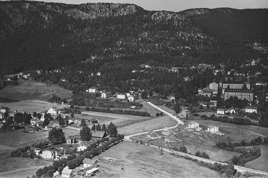
Norsk bokmål: Veikrysset i bildet består av gatene: Killingrudalleen, Gamle riksvei og Solbergveien. I starten av Killingrudalleen er Solberg kapell og på tomta der Solberg sport og kultursenter befinner seg i nyere tid er Solberg bruksskole fra 1918. Bildet er et flyfoto av Widerøes Flyveselskap AS, fra 1955. Kilde: Drammen kommunes mediearkiv. Bildet er beskjært og støy redusert |
| Date | |
| Source | https://urn.nb.no/URN:NBN:no-nb_digifoto_20160509_00120_NB_WF_NEK_086816 |
| Author | Widerøes Flyveselskap AS |
| Object location | | View this and other nearby images on: OpenStreetMap |
|---|
Licensing
edit
| This file is made available under the Creative Commons CC0 1.0 Universal Public Domain Dedication. | |
| The person who associated a work with this deed has dedicated the work to the public domain by waiving all of their rights to the work worldwide under copyright law, including all related and neighboring rights, to the extent allowed by law. You can copy, modify, distribute and perform the work, even for commercial purposes, all without asking permission.
|
File history
Click on a date/time to view the file as it appeared at that time.
| Date/Time | Thumbnail | Dimensions | User | Comment | |
|---|---|---|---|---|---|
| current | 22:55, 19 March 2023 | | 7,270 × 4,833 (5.9 MB) | TigerfraMars (talk | contribs) | Uploaded a work by Widerøes Flyveselskap AS from https://urn.nb.no/URN:NBN:no-nb_digifoto_20160509_00120_NB_WF_NEK_086816 with UploadWizard |
You cannot overwrite this file.
File usage on Commons
There are no pages that use this file.
File usage on other wikis
The following other wikis use this file:
- Usage on no.wikipedia.org