File:USACE Port Orford Oregon.jpg

Size of this preview: 600 × 600 pixels. Other resolutions: 240 × 240 pixels | 480 × 480 pixels | 768 × 768 pixels | 1,024 × 1,024 pixels | 1,500 × 1,500 pixels.
Original file (1,500 × 1,500 pixels, file size: 619 KB, MIME type: image/jpeg)
Captions
Captions
Add a one-line explanation of what this file represents
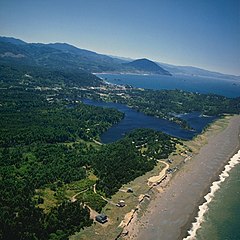
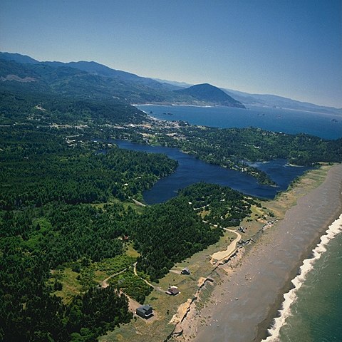
| Description | Aerial view of Port Orford, Oregon, USA. View is to the southeast. | |||
| Location | Port Orford, Oregon, USA 42°45′17.83″N 124°30′37.35″W / 42.7549528°N 124.510375°W |
|||
| Date | ||||
| Source |
U.S. Army Corps of Engineers Digital Visual Library Image page Image description page Digital Visual Library home page |
|||
| Author | Bob Heims, U.S. Army Corps of Engineers | |||
| Permission (Reusing this file) |
|
File history
Click on a date/time to view the file as it appeared at that time.
| Date/Time | Thumbnail | Dimensions | User | Comment | |
|---|---|---|---|---|---|
| current | 21:32, 18 March 2007 | | 1,500 × 1,500 (619 KB) | DanMS (talk | contribs) | {{Information | Description = Aerial view of Port Orford, Oregon, USA. View is to the southeast. | Source = U.S. Army Corps of Engineers Digital Visual Library<br />[http://images.usace.army.mil/images/Hires/Poo0048.Jpg Image page]<br />[http://image |
You cannot overwrite this file.
File usage on Commons
There are no pages that use this file.
File usage on other wikis
The following other wikis use this file:
- Usage on ceb.wikipedia.org
- Usage on es.wikipedia.org