File:USGS Kīlauea multimediaFile-1932.jpg

Size of this preview: 800 × 533 pixels. Other resolutions: 320 × 213 pixels | 640 × 427 pixels | 1,024 × 683 pixels | 1,280 × 853 pixels | 2,560 × 1,707 pixels | 6,000 × 4,000 pixels.
Original file (6,000 × 4,000 pixels, file size: 8.17 MB, MIME type: image/jpeg)
Captions
Captions
Add a one-line explanation of what this file represents
Summary edit
| Description |
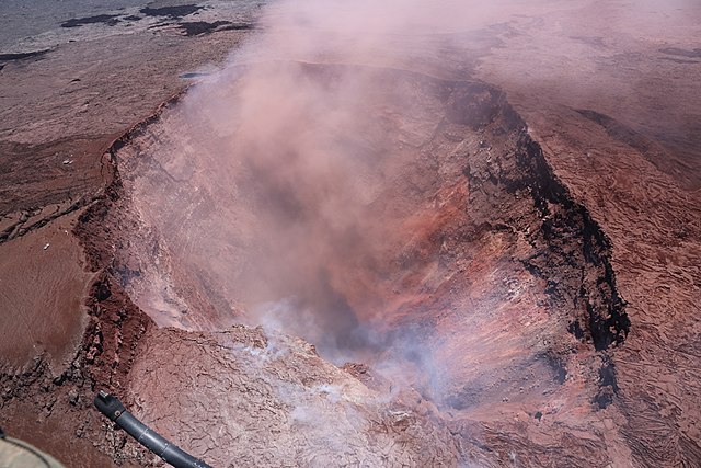
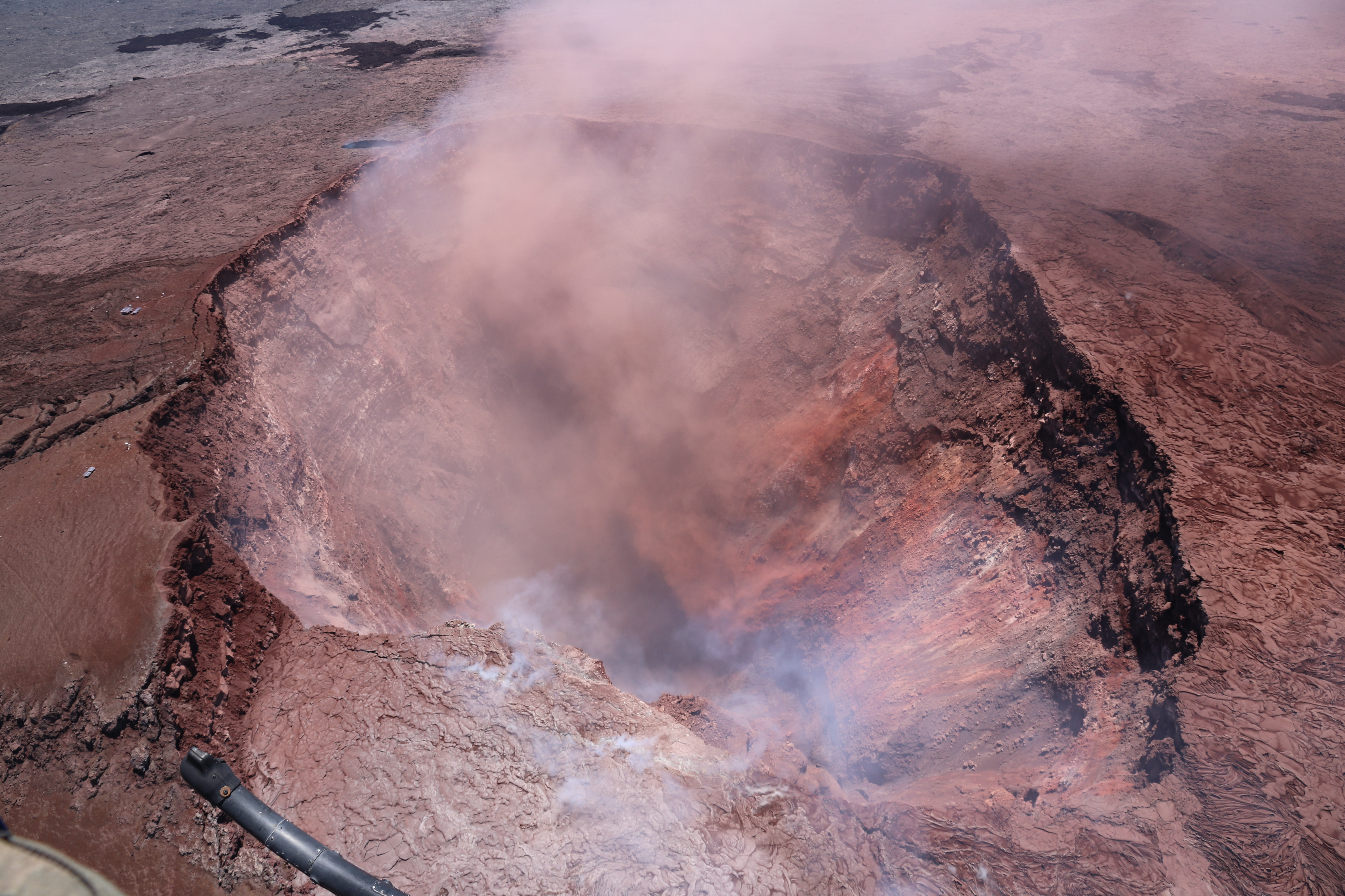
Kīlauea's 2018 lower Puna eruption. After a long period of rain and low clouds, improved weather and high clouds today allowed good airborne observations of the collapse crater in Puʻu ʻŌʻō. This photo looks to the east, and shows the deep collapse crater formed on Monday, April 30, when magma beneath Pu‘u ‘Ō‘ō drained. For scale, the crater is about 250 meters (820 feet) wide. |
| Date | |
| Source |
https://volcanoes.usgs.gov/volcanoes/kilauea/multimedia_chronology.html https://volcanoes.usgs.gov/observatories/hvo/multimedia_uploads/multimediaFile-1932.jpg |
| Author | United States Geological Survey |
| Object location | | View this and other nearby images on: OpenStreetMap |
|---|
Licensing edit
This image is in the public domain in the United States because it only contains materials that originally came from the United States Geological Survey, an agency of the United States Department of the Interior. For more information, see the official USGS copyright policy.
|
File history
Click on a date/time to view the file as it appeared at that time.
| Date/Time | Thumbnail | Dimensions | User | Comment | |
|---|---|---|---|---|---|
| current | 04:05, 17 November 2018 | | 6,000 × 4,000 (8.17 MB) | Batholith (talk | contribs) | == {{int:filedesc}} == {{Information |description= Kīlauea's 2018 lower Puna eruption. {{Quote box |After a long period of rain and low clouds, improved weather and high clouds today allowed good airborne observations of the collapse crater in Puʻu ʻŌʻō. This photo looks to the east, and shows the deep collapse crater formed on Monday, April 30, when magma beneath Pu‘u ‘Ō‘ō drained. For scale, the crater is about 250 meters (... |
You cannot overwrite this file.
File usage on Commons
The following page uses this file:
File usage on other wikis
The following other wikis use this file:
- Usage on ja.wikipedia.org