File:USGS Map of Kimball Creek and McLeod Creek confluence, the sources of East Canyon Creek.png
Size of this preview: 472 × 600 pixels. Other resolutions: 189 × 240 pixels | 378 × 480 pixels | 604 × 768 pixels | 1,198 × 1,522 pixels.
Original file (1,198 × 1,522 pixels, file size: 445 KB, MIME type: image/png)
Captions
Captions
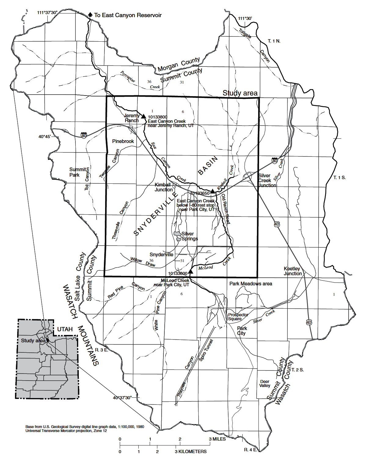
Map of Kimball Creek and McLeod Creek confluence, the source of East Canyon Creek in Summit County, Utah.
Summary
edit
| Description |
English: Map of Kimball Creek and McLeod Creek confluence, the source of East Canyon Creek in Summit County, Utah. This map is from a USGS report entitled Seepage Study of McLeod Creek and East Canyon Creek near Park City, Summit County, Utah, 2004, Scientific Report Report 2005-5164 by author C.D. Wilkowske published by the USGS in 2005. |
| Date | |
| Source | https://pubs.usgs.gov/sir/2005/5164/PDF/SIR2005_5164.pdf |
| Author | USGS Report by C.D. Wilkowske, 2005 |
Licensing
edit
This image is in the public domain in the United States because it only contains materials that originally came from the United States Geological Survey, an agency of the United States Department of the Interior. For more information, see the official USGS copyright policy.
|
File history
Click on a date/time to view the file as it appeared at that time.
| Date/Time | Thumbnail | Dimensions | User | Comment | |
|---|---|---|---|---|---|
| current | 18:16, 22 July 2023 | | 1,198 × 1,522 (445 KB) | Schmiebel (talk | contribs) | Uploaded a work by USGS Report by C.D. Wilkowske, 2005 from https://pubs.usgs.gov/sir/2005/5164/PDF/SIR2005_5164.pdf with UploadWizard |
You cannot overwrite this file.
File usage on Commons
There are no pages that use this file.
File usage on other wikis
The following other wikis use this file:
- Usage on en.wikipedia.org