File:USSR map NK 43-7 Tashkumyr.jpg
Size of this preview: 792 × 600 pixels. Other resolutions: 317 × 240 pixels | 634 × 480 pixels | 1,014 × 768 pixels | 1,280 × 969 pixels | 2,560 × 1,938 pixels | 5,000 × 3,786 pixels.
Original file (5,000 × 3,786 pixels, file size: 4.11 MB, MIME type: image/jpeg)
Captions
Captions
Add a one-line explanation of what this file represents
Summary edit
| Description |
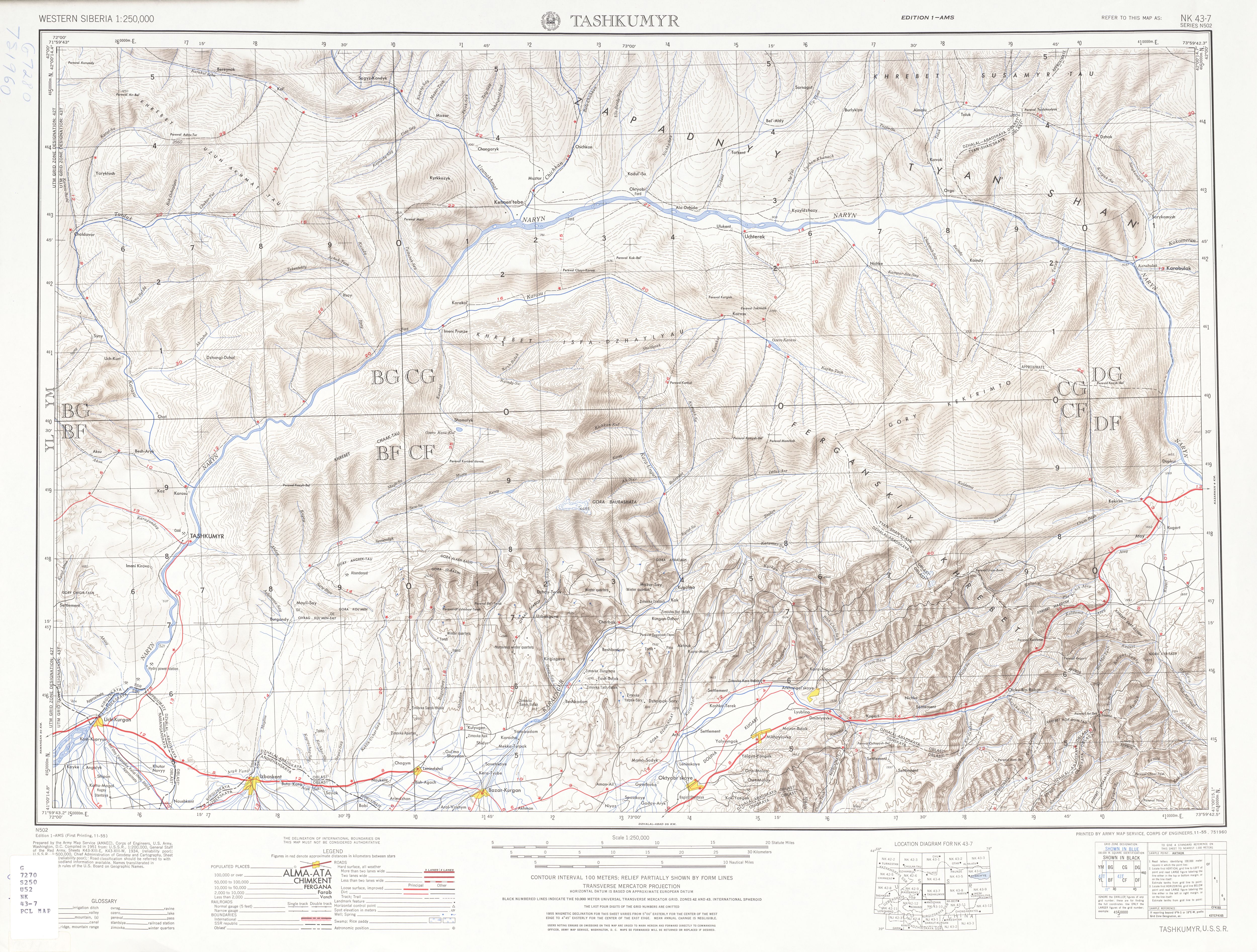
English: List from Western Siberia AMS Topographic Maps. Series N502, U.S. Army Map Service, 1955
Русский: Лист из набора картЗападной Сибири Картографической военной службы США. Серия 502. 1955 |
| Date | |
| Source | A Univercity of Texas libraries |
| Author |
English: U.S. Army Map Service |
Licensing edit
This file is a work of a U.S. Army soldier or employee, taken or made as part of that person's official duties. As a work of the U.S. federal government, it is in the public domain in the United States.
|
 |
File history
Click on a date/time to view the file as it appeared at that time.
| Date/Time | Thumbnail | Dimensions | User | Comment | |
|---|---|---|---|---|---|
| current | 15:58, 12 September 2010 | | 5,000 × 3,786 (4.11 MB) | ShinePhantom (talk | contribs) |
You cannot overwrite this file.
File usage on Commons
There are no pages that use this file.