File:US Geo survey hurricane jose 2017.jpg

Size of this preview: 800 × 464 pixels. Other resolutions: 320 × 186 pixels | 640 × 371 pixels | 1,024 × 594 pixels | 1,280 × 743 pixels | 2,048 × 1,188 pixels.
Original file (2,048 × 1,188 pixels, file size: 224 KB, MIME type: image/jpeg)
Captions
Captions
Add a one-line explanation of what this file represents
Summary edit
| Description |
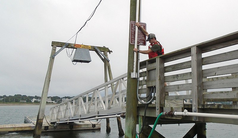
English: In response to Hurricane Jose, U.S. Geological Survey specialists across three states installed 17 storm-tide sensors – seven in Connecticut, seven in Massachusetts and three in Rhode Island – along shorelines likely to receive some large waves and storm surge from the storm.
These scientific instruments were put in place ahead of Jose to collect information about the hurricane’s effects on the coast. The retrieval of the sensors and the valuable data they hold will begin once Jose has passed. To learn where the storm-tide sensors were deployed for Jose, visit the USGS Hurricane Jose Flood Event Viewer. The U.S. Geological Survey use many forms of technology to track and document the effects of hurricanes along the Gulf and Atlantic coasts. |
| Date | |
| Source | https://www.facebook.com/USGeologicalSurvey/photos/a.169734339739224.34845.102635589782433/1544019712310673/?type=3&theater |
| Author | US Geological Survey |
Licensing edit
This image is in the public domain in the United States because it only contains materials that originally came from the United States Geological Survey, an agency of the United States Department of the Interior. For more information, see the official USGS copyright policy.
|
File history
Click on a date/time to view the file as it appeared at that time.
| Date/Time | Thumbnail | Dimensions | User | Comment | |
|---|---|---|---|---|---|
| current | 23:46, 19 September 2017 | | 2,048 × 1,188 (224 KB) | Victorgrigas (talk | contribs) | User created page with UploadWizard |
You cannot overwrite this file.
File usage on Commons
There are no pages that use this file.
File usage on other wikis
The following other wikis use this file:
- Usage on en.wikipedia.org
- Usage on es.wikipedia.org
- Usage on zh.wikipedia.org