File:US federal land.agencies.svg

Size of this PNG preview of this SVG file: 776 × 600 pixels. Other resolutions: 311 × 240 pixels | 621 × 480 pixels | 994 × 768 pixels | 1,280 × 989 pixels | 2,560 × 1,978 pixels | 990 × 765 pixels.
Original file (SVG file, nominally 990 × 765 pixels, file size: 3.65 MB)
Captions
Captions
Add a one-line explanation of what this file represents
Department of Defense (includes Army Corps of Engineers projects)
Other agencies
Summary edit
| Description |
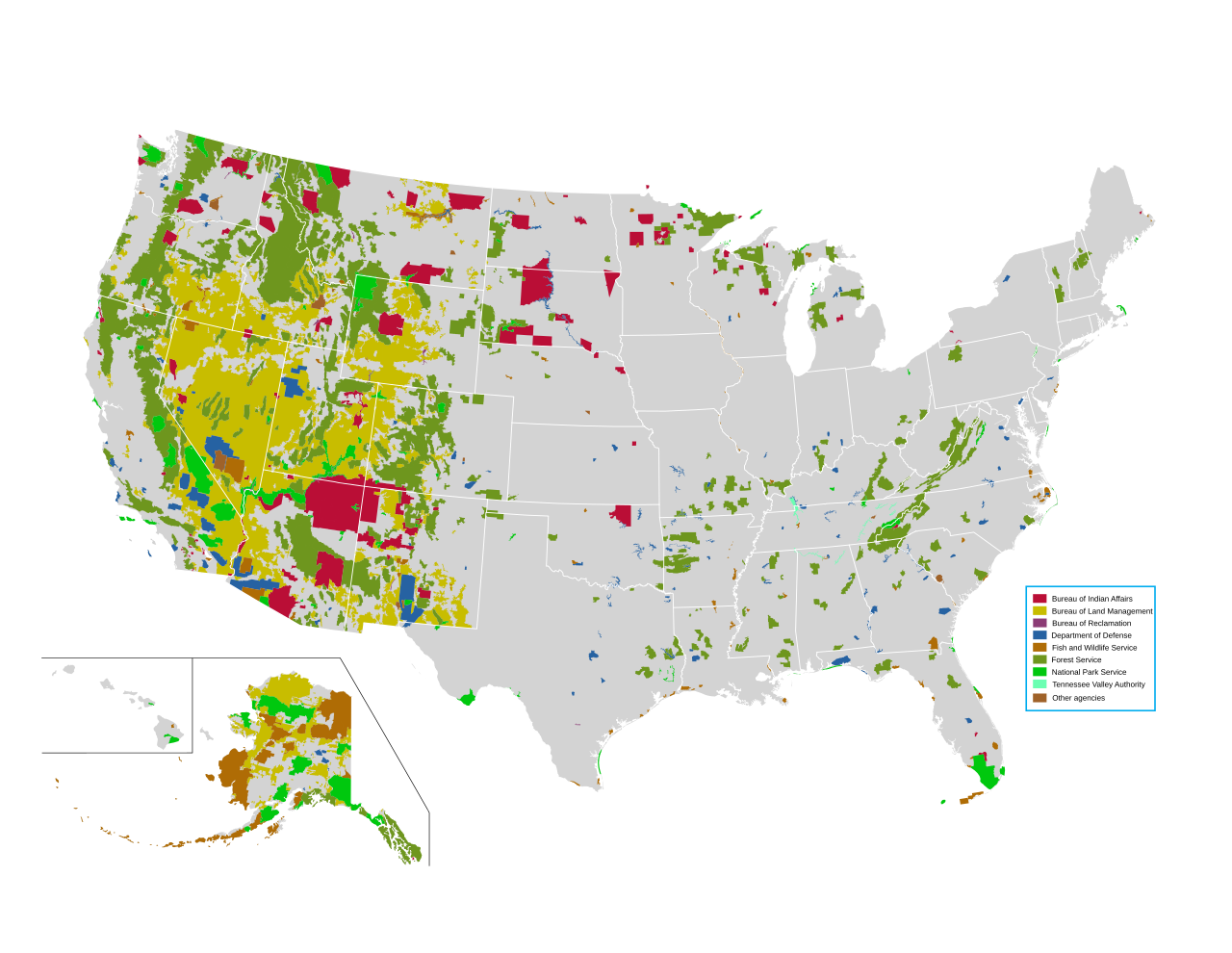
English: Map of all federally owned land in the United States. |
| Source | http://nationalatlas.gov/printable/fedlands.html, "All Federal and Indian Lands" |
| Author | National Atlas of the United States |
Licensing edit
This map was obtained from an edition of the National Atlas of the United States. Like almost all works of the U.S. federal government, works from the National Atlas are in the public domain in the United States.
Online access: NationalAtlas.gov | 1970 print edition: Library of Congress, Perry-Castañeda Library
|
File history
Click on a date/time to view the file as it appeared at that time.
| Date/Time | Thumbnail | Dimensions | User | Comment | |
|---|---|---|---|---|---|
| current | 22:42, 14 April 2014 | | 990 × 765 (3.65 MB) | Interiot~commonswiki (talk | contribs) | fix text alignment |
| 22:34, 14 April 2014 |  | 990 × 765 (3.65 MB) | Interiot~commonswiki (talk | contribs) | fix text alignment | |
| 22:27, 14 April 2014 |  | 990 × 765 (3.65 MB) | Interiot~commonswiki (talk | contribs) |
You cannot overwrite this file.
File usage on Commons
There are no pages that use this file.
File usage on other wikis
The following other wikis use this file:
- Usage on en.wikipedia.org
- United States Forest Service
- Bureau of Land Management
- Public land
- Public domain (land)
- Sagebrush Rebellion
- Federal lands
- User:Kazkaskazkasako/Books/History
- Bundy standoff
- Grazing rights in Nevada
- Wikipedia:Reference desk/Archives/Humanities/2015 June 15
- Public lands in the United States
- Administrative state
- Environmental history of the United States
- Usage on en.wikivoyage.org
- Usage on fr.wikipedia.org
- Usage on he.wikipedia.org
- Usage on it.wikipedia.org
- Usage on pt.wikipedia.org
- Usage on ru.wikipedia.org
- Usage on sv.wikipedia.org
- Usage on zh.wikipedia.org