File:Ukraine relief location map.jpg

Size of this preview: 800 × 538 pixels. Other resolutions: 320 × 215 pixels | 640 × 431 pixels | 1,024 × 689 pixels | 1,280 × 861 pixels | 1,720 × 1,157 pixels.
Original file (1,720 × 1,157 pixels, file size: 1.14 MB, MIME type: image/jpeg)
Captions
Captions
Add a one-line explanation of what this file represents
| Description |
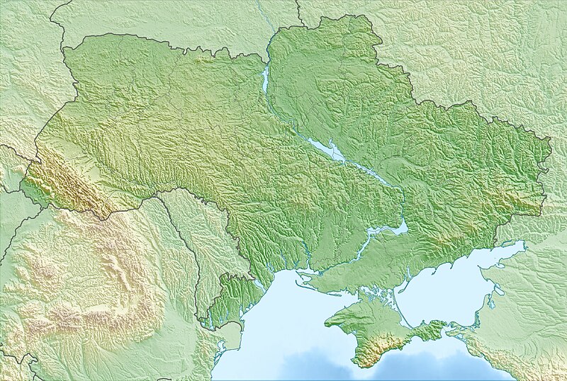
Deutsch: Physische Positionskarte der Ukraine
Quadratische Plattkarte, N-S-Streckung 150 %. Geographische Begrenzung der Karte:
English: Physical location map of Ukraine
Equirectangular projection, N/S stretching 150 %. Geographic limits of the map:
|
| Date | |
| Source | Own work, using map data from administrative map by NordNordWest. The relief was created from SRTM-30 relief data |
| Author | Carport |
| Permission (Reusing this file) |
This file is licensed under the Creative Commons Attribution-Share Alike 3.0 Unported license.
|
| Other versions |
|

File history
Click on a date/time to view the file as it appeared at that time.
| Date/Time | Thumbnail | Dimensions | User | Comment | |
|---|---|---|---|---|---|
| current | 16:24, 12 March 2010 | | 1,720 × 1,157 (1.14 MB) | Carport (talk | contribs) | {{Information |Description={{de|Physische Positionskarte der {{w|Ukraine|3=de}}}} Quadratische Plattkarte, N-S-Streckung 150 %. Geographische Begrenzung der Karte: * N: 52.7° N * S: 44.1° N * W: 21.5° O * O: 40.7° O {{en|Physical location map of {{w|U |
You cannot overwrite this file.
File usage on Commons
The following 10 pages use this file:
- Україна
- User:Albedo-ukr
- File:Ukraine (1991-2014) location map.svg
- File:Ukraine according to Russian claims (2022) location map (1917 highlighted).svg
- File:Ukraine location map.svg
- File:Повітряне командування «Захід».png
- File:Повітряне командування «Південь».png
- File:Повітряне командування «Центр».png
- File:Повітряний простір України.png
- Category:Ukraine
_location_map.svg)
_location_map_(1917_highlighted).svg)
File usage on other wikis
The following other wikis use this file:
- Usage on als.wikipedia.org
- Usage on ar.wikipedia.org
- Usage on av.wikipedia.org
- Usage on azb.wikipedia.org
- Usage on az.wikipedia.org
- Krım
- Çernobıl AES
- Şablon:Yer xəritəsi Ukrayna
- Kerç yarımadası
- Qenices boğazı
- Çonqar boğazı
- Arabat boğazı
- Dnestrovsko-Çareqradskoe qirlo
- Or bərzəxi
- Aq-Manay bərzəği
- Kerç boğazı
- Qoverla
- Zmeynıy adası
- Optimistiçeskaya mağarası
- Sınevir
- Brebeneskul
- Adalar adası
- Arabat əqrəbi
- Qılburun dili
- Aleşkov qumları
- Baqqal dili
- Belıe Kuçuqurı
- Obitoçnaya dili
- Krivaya dili
- Belosaray dili
- Tuzla dili
- Biryoçiy adası
- Fedotov dili
- Berdyan dili
- Yəşəm çimərliyi
- Massandra çimərliyi
- Müqəddəs Hadisə qayası
- Alyaud yarımadası
- Çonqar yarımadası
- Yaqorliski Kut
- Tərxan Qut yarımadası
- Litovski yarımadası
- İqren yarımadası
View more global usage of this file.