File:Umgebung von Zadar, 1869.tif
Original file (982 × 737 pixels, file size: 2.75 MB, MIME type: image/tiff)
Captions
Captions
Summary edit
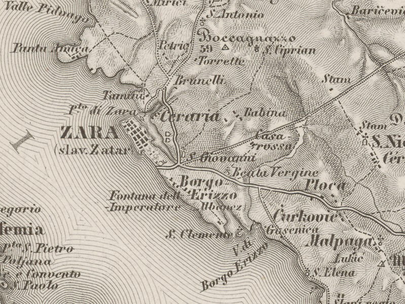
| Description | Umgebung von Zadar (Kartenbeschreibung, Details) |
| Date | |
| Source |
Special-Karte des Koenigreiches Dalmatien. Karte aus dem Bestand des Projekts GeoPortOst am Leibniz-Instituts für Ost- und Südosteuropaforschung English: Map from the collection GeoPortOst at the Leibniz-Institute for East and Southeast European Studies |
| Author | Kaiserlich-Königliches Militär-Geographisches Institut (Wien) (Ed.) |
| Other versions |

File digitized within the project GeoPortOst (http://geoportost.ios-regensburg.de/) by the University Library Regensburg 2016.
Licensing edit
|
This work is in the public domain in its country of origin and other countries and areas where the copyright term is the author's life plus 70 years or fewer.
| |
| This file has been identified as being free of known restrictions under copyright law, including all related and neighboring rights. | |
File history
Click on a date/time to view the file as it appeared at that time.
| Date/Time | Thumbnail | Dimensions | User | Comment | |
|---|---|---|---|---|---|
| current | 19:33, 23 October 2020 |  | 982 × 737 (2.75 MB) | Dans (talk | contribs) | File:BV043564102.tif cropped 85 % horizontally, 84 % vertically using CropTool with precise mode. |
You cannot overwrite this file.
File usage on Commons
The following 2 pages use this file: