File:United Kingdom - location map.png

Size of this preview: 388 × 600 pixels. Other resolutions: 155 × 240 pixels | 310 × 480 pixels | 885 × 1,368 pixels.
Original file (885 × 1,368 pixels, file size: 132 KB, MIME type: image/png)
Captions
Captions
Add a one-line explanation of what this file represents
Summary
edit
| Description |
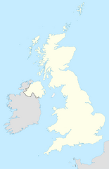
English: Location map of the United Kingdom Français : Carte de location du Royaume Uni
Equirectangular projection, N/S stretching 170 %. Geographic limits of the map:
|
| Date | |
| Source | based on United Kingdom location map.svg |
| Author | User:Hogweard |
| Other versions | United Kingdom location map.svg |
Licensing
edit
| I, the copyright holder of this work, release this work into the public domain. This applies worldwide. In some countries this may not be legally possible; if so: I grant anyone the right to use this work for any purpose, without any conditions, unless such conditions are required by law. |
File history
Click on a date/time to view the file as it appeared at that time.
| Date/Time | Thumbnail | Dimensions | User | Comment | |
|---|---|---|---|---|---|
| current | 23:05, 28 January 2010 | | 885 × 1,368 (132 KB) | Hogweard (talk | contribs) | == {{int:filedesc}} == {{Information |Description= {{en|Location map of the en:United Kingdom}} {{fr|Carte de location du fr:Royaume Uni}} Equirectangular projection, N/S stretching 170 %. Geographic limits of the map: * N: 61.0° N * S: 49.0° N |
You cannot overwrite this file.
File usage on Commons
The following page uses this file:
File usage on other wikis
The following other wikis use this file:
- Usage on ang.wikipedia.org
- Usage on bn.wikipedia.org
- Usage on en.wikipedia.org