File:United Kingdom EU referendum 2016 area results (Northern Ireland).svg

Size of this PNG preview of this SVG file: 705 × 599 pixels. Other resolutions: 282 × 240 pixels | 565 × 480 pixels | 903 × 768 pixels | 1,205 × 1,024 pixels | 2,409 × 2,048 pixels | 1,208 × 1,027 pixels.
Original file (SVG file, nominally 1,208 × 1,027 pixels, file size: 95 KB)
Captions
Captions
Add a one-line explanation of what this file represents
Summary edit
| Description |
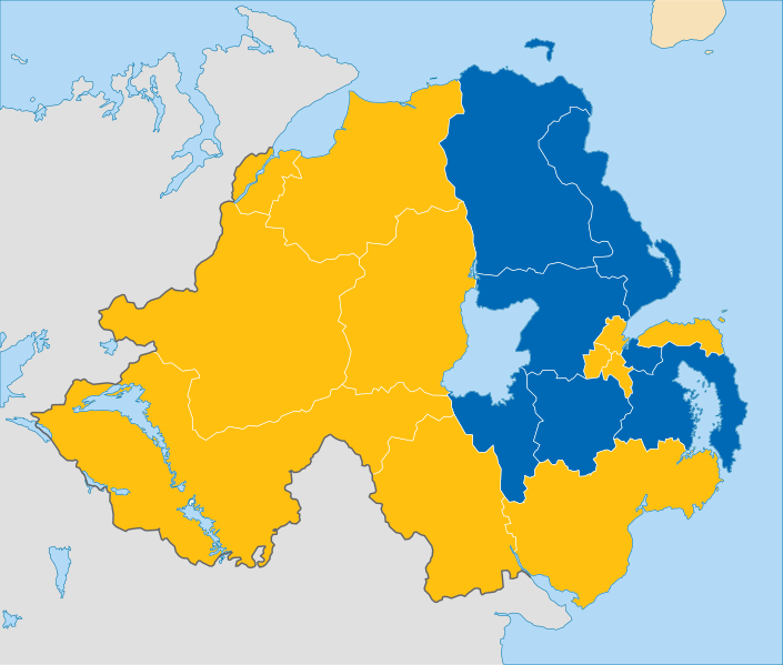
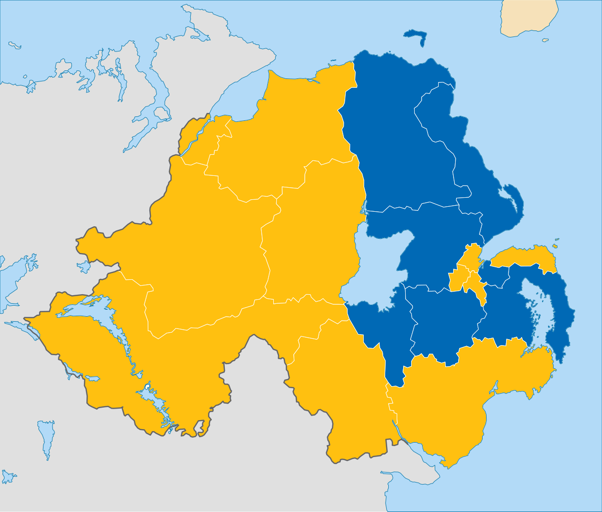
English: Results of the European Union membership referendum, 2016 in the Northern Ireland region.
Remain
Leave |
||
| Date | |||
| Source | This work is derived from File:Northern Ireland location map.svg by NordNordWest (which contains United States National Imagery and Mapping Agency data). The style of the map is adapded to that of the other referendum results maps | ||
| Author | Furfur | ||
| Permission (Reusing this file) |
I, the copyright holder of this work, hereby publish it under the following licenses:
This file is licensed under the Creative Commons Attribution-Share Alike 4.0 International license.
You may select the license of your choice. |

.svg&action=edit§ion=1)
File history
Click on a date/time to view the file as it appeared at that time.
| Date/Time | Thumbnail | Dimensions | User | Comment | |
|---|---|---|---|---|---|
| current | 11:49, 26 January 2019 | | 1,208 × 1,027 (95 KB) | YourGloriousLeader (talk | contribs) | Minified version 67% smaller |
| 08:30, 26 October 2016 |  | 1,208 × 1,027 (182 KB) | Nilfanion (talk | contribs) | Reverted, per COM:OVERWRITE substantial changes should be as a new file | |
| 01:17, 15 October 2016 |  | 1,208 × 1,027 (204 KB) | Renamed user OCfxJKu7j2 (talk | contribs) | Added scale | |
| 07:03, 24 June 2016 |  | 1,208 × 1,027 (182 KB) | EmmaCoop (talk | contribs) | Update | |
| 11:48, 23 June 2016 |  | 1,208 × 1,027 (123 KB) | Furfur (talk | contribs) | corrected the constituency borders | |
| 09:38, 23 June 2016 |  | 1,208 × 1,027 (171 KB) | Furfur (talk | contribs) | adjusted borderlines | |
| 09:34, 23 June 2016 |  | 1,208 × 1,027 (168 KB) | Furfur (talk | contribs) | =={{int:filedesc}}== {{Information |description={{en|1=Results of the European Union membership referendum, 2016 in the Northern Ireland region.}} |date=2016-06-23 |source=This work is derived from File:Northern Ireland location map.svg by {{U|Nor... |
You cannot overwrite this file.
File usage on Commons
The following 5 pages use this file:
- User:Magog the Ogre/Political maps/2016 June 21-30
- User:Magog the Ogre/Political maps/2016 October 11-20
- User:Magog the Ogre/Political maps/2016 October 21-31
- User:Magog the Ogre/Political maps/2019 January 21-31
- File:United Kingdom European Union referendum 2016 voting area results (Northern Ireland).svg
.svg)
File usage on other wikis
The following other wikis use this file:
- Usage on cy.wikipedia.org
- Usage on de.wikipedia.org
- Usage on el.wikipedia.org
- Usage on en.wikipedia.org
- Usage on fi.wikipedia.org
- Usage on ko.wikipedia.org
- Usage on pl.wikipedia.org
- Usage on pt.wikipedia.org
.svg&oldid=850108931)