File:United States House of Representatives, West Virginia District 3 map.png
No higher resolution available.
United_States_House_of_Representatives,_West_Virginia_District_3_map.png (635 × 379 pixels, file size: 30 KB, MIME type: image/png)
Captions
Captions
Add a one-line explanation of what this file represents
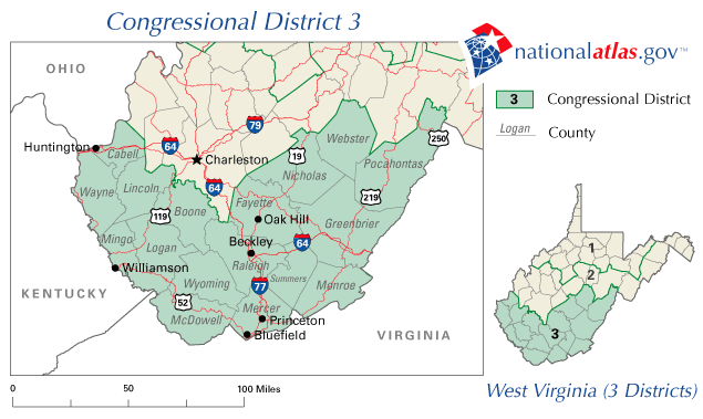
A map of United States House of Representatives, West Virginia District 3.
The map is from nationalatlas.gov, specifically WV03_109.gif.
This map was obtained from an edition of the National Atlas of the United States. Like almost all works of the U.S. federal government, works from the National Atlas are in the public domain in the United States.
Online access: NationalAtlas.gov | 1970 print edition: Library of Congress, Perry-Castañeda Library
|
File history
Click on a date/time to view the file as it appeared at that time.
| Date/Time | Thumbnail | Dimensions | User | Comment | |
|---|---|---|---|---|---|
| current | 21:06, 31 March 2006 | | 635 × 379 (30 KB) | Dbenbenn (talk | contribs) | PD-USGov-Atlas |
You cannot overwrite this file.
File usage on Commons
There are no pages that use this file.
File usage on other wikis
The following other wikis use this file:
- Usage on en.wikipedia.org
- West Virginia's 3rd congressional district
- 2008 United States House of Representatives elections in West Virginia
- 2010 United States House of Representatives elections in West Virginia
- 2006 United States House of Representatives elections in West Virginia
- 2004 United States House of Representatives elections in West Virginia
- 2002 United States House of Representatives elections in West Virginia