File:Université Lille I map.svg

Size of this PNG preview of this SVG file: 618 × 600 pixels. Other resolutions: 247 × 240 pixels | 494 × 480 pixels | 791 × 768 pixels | 1,055 × 1,024 pixels | 2,110 × 2,048 pixels | 1,266 × 1,229 pixels.
Original file (SVG file, nominally 1,266 × 1,229 pixels, file size: 1.54 MB)
Captions
Captions
Add a one-line explanation of what this file represents
Summary edit
| Description |
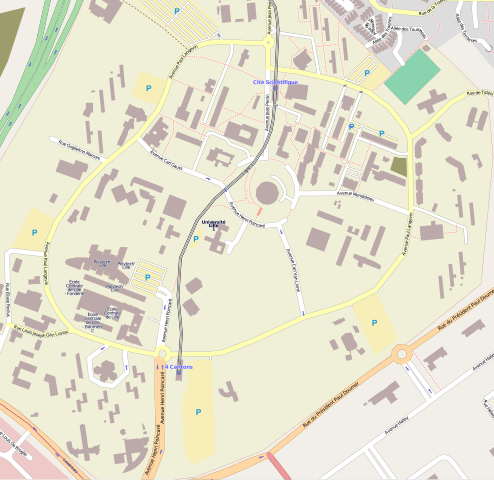
Université Lille Nord de France - Campus Lille I - Cité scientifique العربية: Campus Lille I - Cité scientifique خريطة جامعة ليل
Français : Carte de la cité scientifique - Campus Lille I - Université Lille Nord de France.
Ce territoire est aussi celui du projet démonstrateur SunRise Smart City English: Campus map - Cité scientifique - Campus Lille I - Université Lille Nord de France
Deutsch: Karte cité scientifique - Campus Lille I - Université Lille Nord de France
Español: Mapa cité scientifique - Campus Lille I - Universidad de Lille Nord-de-France
Italiano: Mappa cité scientifique - Campus Lille I - Université Lille Nord de France
Nederlands: Kaart cité scientifique - Campus Lille I - Université Lille Nord de France
Português: Mapa cité scientifique - Campus Lille I - Université Lille Nord de France
Русский: карта cité scientifique - Campus Lille I - Университет Лилля — Северной Франции |
| Date | |
| Source | Openstreetmap |
| Author | OpenStreetMap contributors |
| Permission (Reusing this file) |
All OpenStreetMap data and maps are Creative Commons "CC-BY-SA 3.0" licensed |
Licensing edit
This file is licensed under the Creative Commons Attribution-Share Alike 3.0 Unported license.
- You are free:
- to share – to copy, distribute and transmit the work
- to remix – to adapt the work
- Under the following conditions:
- attribution – You must give appropriate credit, provide a link to the license, and indicate if changes were made. You may do so in any reasonable manner, but not in any way that suggests the licensor endorses you or your use.
- share alike – If you remix, transform, or build upon the material, you must distribute your contributions under the same or compatible license as the original.
| Annotations | This image is annotated: View the annotations at Commons |
File history
Click on a date/time to view the file as it appeared at that time.
| Date/Time | Thumbnail | Dimensions | User | Comment | |
|---|---|---|---|---|---|
| current | 13:44, 16 February 2010 | | 1,266 × 1,229 (1.54 MB) | Frédéric Kuhlmann (talk | contribs) | {{Information |Description=Université Lille I - map |Source= Openstreetmap |Date= 15/02/2010 |Author={{{authors|OpenStreetMap contributors}}} |Permission=All OpenStreetMap data and maps are Creative Commons "CC-BY-SA 3.0" licensed |other_versions= }} |
You cannot overwrite this file.
File usage on Commons
The following 7 pages use this file:
File usage on other wikis
The following other wikis use this file:
- Usage on ar.wikipedia.org
- Usage on eu.wikipedia.org
- Usage on fr.wikipedia.org
- Université Lille-I
- Laboratoire d'automatique, génie informatique et signal
- Laboratoire de mécanique de Lille
- Laboratoire Paul Painlevé
- Cité scientifique
- Laboratoire de physique des lasers, atomes et molécules
- Institut de recherche sur les composants logiciels et matériels pour l'information et la communication avancée de Lille
- SunRise (ville intelligente)
- Faculté des sciences et technologies de Lille
- Usage on ro.wikipedia.org
- Usage on uk.wikipedia.org
- Usage on www.wikidata.org