File:Upper High Street, Taunton (2020) 01-04.JPG
Size of this preview: 800 × 600 pixels. Other resolutions: 320 × 240 pixels | 640 × 480 pixels | 1,024 × 768 pixels | 1,280 × 960 pixels | 1,366 × 1,024 pixels.
Original file (1,366 × 1,024 pixels, file size: 407 KB, MIME type: image/jpeg)
Captions
Captions
Add a one-line explanation of what this file represents
Summary
edit_01-04.JPG&action=edit§ion=1)
| Description |
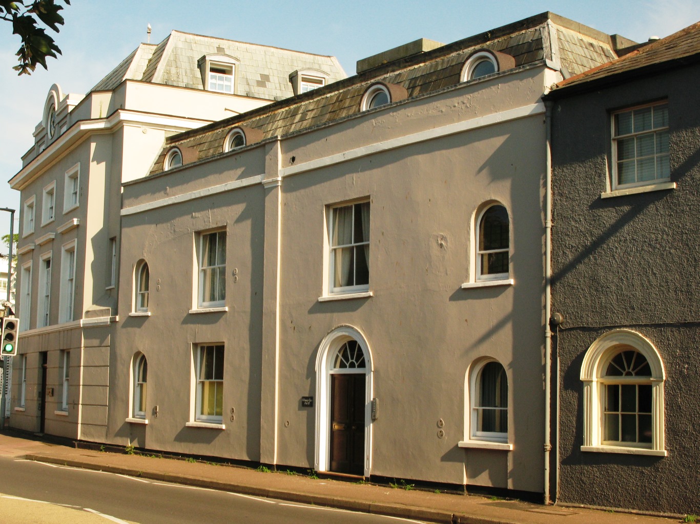
English: Upper High Street in Taunton forms part of the A38 road, a continuation of Mary Street (to the east) and continuing past County Hall to Compass Hill. The main High Street runs north from the junction with Mary Street. This row of Georgian buildings form the east end on the south side. The entrance to Vivary Park faces the main High Street beyond number 1 on the left. |
| Date | |
| Source | Own work |
| Author | Geof Sheppard |
Licensing
edit_01-04.JPG&action=edit§ion=2)
I, the copyright holder of this work, hereby publish it under the following licenses:
This file is licensed under the Creative Commons Attribution-Share Alike 4.0 International license.
- You are free:
- to share – to copy, distribute and transmit the work
- to remix – to adapt the work
- Under the following conditions:
- attribution – You must give appropriate credit, provide a link to the license, and indicate if changes were made. You may do so in any reasonable manner, but not in any way that suggests the licensor endorses you or your use.
- share alike – If you remix, transform, or build upon the material, you must distribute your contributions under the same or compatible license as the original.

|
Permission is granted to copy, distribute and/or modify this document under the terms of the GNU Free Documentation License, Version 1.2 or any later version published by the Free Software Foundation; with no Invariant Sections, no Front-Cover Texts, and no Back-Cover Texts. A copy of the license is included in the section entitled GNU Free Documentation License. |
You may select the license of your choice.
File history
Click on a date/time to view the file as it appeared at that time.
| Date/Time | Thumbnail | Dimensions | User | Comment | |
|---|---|---|---|---|---|
| current | 17:21, 27 September 2020 | | 1,366 × 1,024 (407 KB) | Geof Sheppard (talk | contribs) | {{Information |description ={{en|1=Upper High Street in Taunton forms part of the A38 road, a continuation of Mary Street (to the east) and continuing past County Hall to Compass Hill. The main High Street runs north from the junction with Mary Street. This row of Georgian buildings form the east end on the south side. The entrance to Vivary Park faces the main High Street beyond number 1 on the left.}} |date =2020-08-08 |source ={{own}} |author =[[User:Geof Sheppard|... |
You cannot overwrite this file.
File usage on Commons
There are no pages that use this file.
_01-04.JPG&oldid=502195452)